The Chronicles

An independent African civilisation.

Six chapters, told on Sudan's own terms — from the mudbrick spires of Kerma to the coral citadel of Suakin, and the living hands between.

Six sovereign perspectives

The Kingdom of Kush, the sacred mountain of Barkal, the volcanic lakes of Jebel Marra, the merchant ports of Suakin and Kassala, and the hands of Sudan's living people — six chapters that trace an African civilisation independent, continuous, and still unfolding.

I — Chapter One

The Sovereign Spires of Kerma.

From 2500 BC, one of Africa's earliest and most formidable independent urban civilisations — risen entirely on its own genius above the Third Cataract.

2500 BC Founded·18 m Deffufa·1,000 yr Sovereign

A city of mudbrick that ruled for a thousand years.

Rising above the fertile plains of the Third Cataract, Kerma developed its architectural and political zenith entirely outside any external imperial sphere. The capital was engineered with specialised residential quarters, bronze-forging complexes, and workshops for blue faience and glazed quartzite.

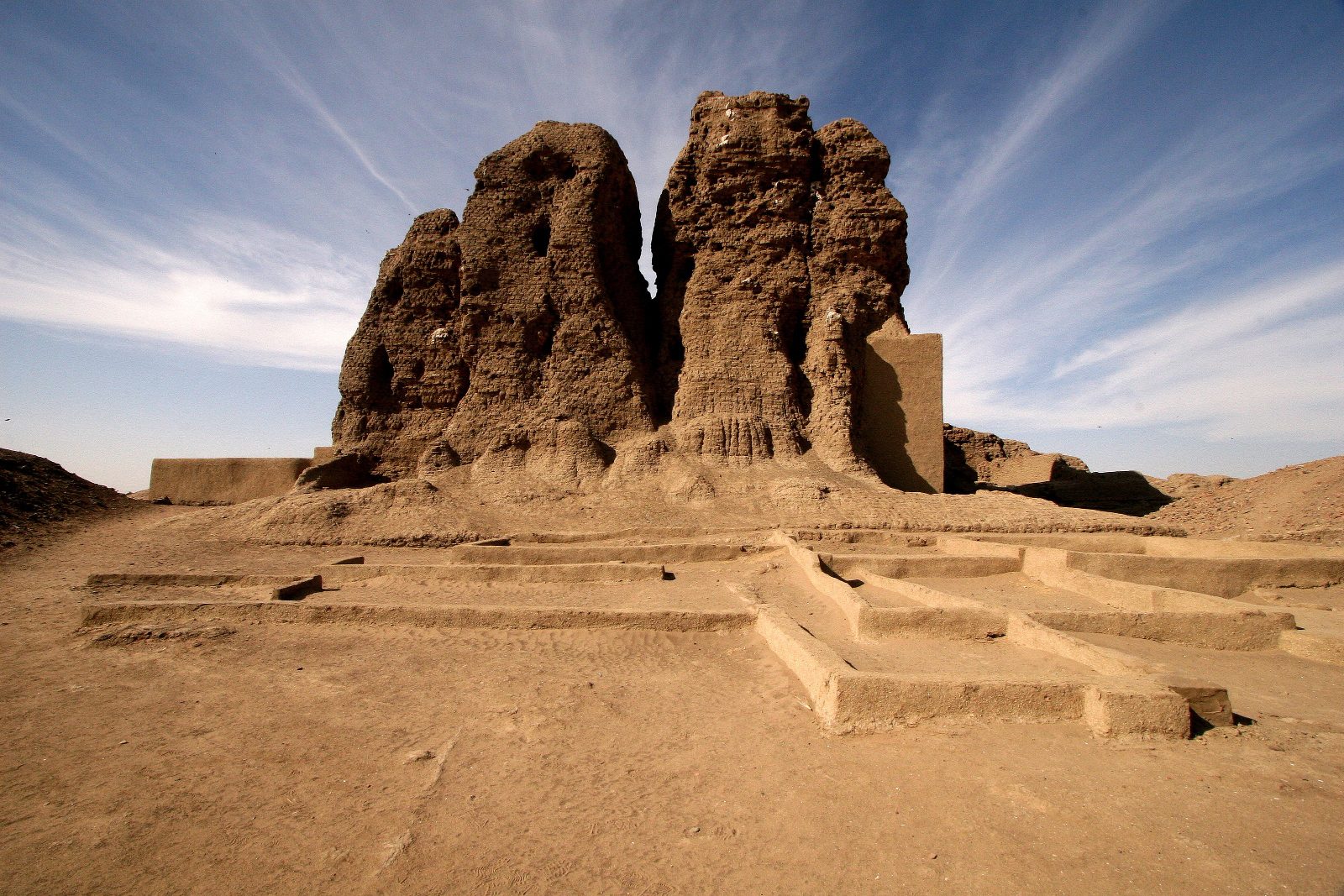
The Western Deffufa

The spiritual heart was the Western Deffufa — a colossal temple of millions of sun-baked bricks, rising over 18 metres. Its builders rejected foreign iconography, relying on an indigenous animist and cosmic theology.

A sovereign African empire that held regional dominance for over a thousand years.The royal necropolis of Kerma

The surrounding royal tumuli, ringed with black sandstone and white quartz pebbles, testify to a state that answered to no one but itself.

II — Chapter Two

The Granite Sentinels of Barkal.

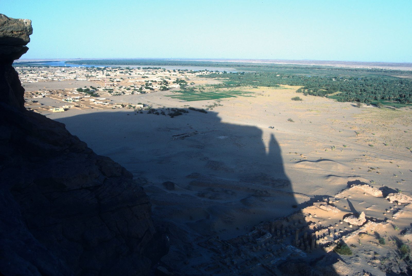
A sandstone mesa rising about 100 metres above the desert — the sacred epicentre of the Kushite Empire and dwelling-place of the god Amun.

≈100 m Holy mountain·Napata·Amun

The mountain where kings were made.

Rising abruptly from flat desert, the isolated mesa of Jebel Barkal was the ultimate sacred epicentre of the Kushite Empire. Its sheer cliffs were recognised as the earthly dwelling of the god Amun.

The sacred landscape of Napata

At its base the kings built the Great Temple of Amun and the rock-cut Temple of Mut. No king could ascend the throne without travelling here for the god's blessing.

An enduring symbol of a completely autonomous, high-culture African state.The Palace of Natakamani

In the Meroitic golden age they raised the Palace of Natakamani on a platform over 61 metres a side, adorned with glazed tiles and sandstone columns.

III — Chapter Three

The Green Crown of the West.

In the heart of Darfur, the volcanic massif of Jebel Marra rises green and cool above the desert — Sudan's highest land, and its most fertile secret.

3,042 m Summit·Deriba Crater lakes·Darfur

A volcano that the desert keeps green.

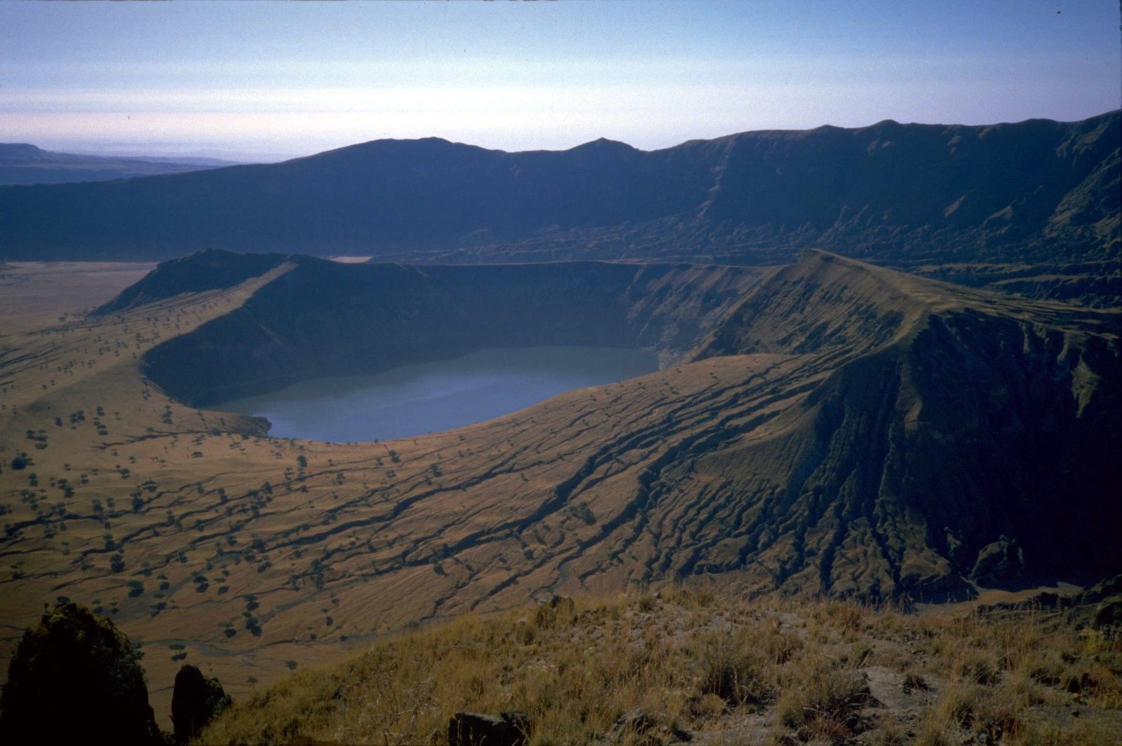
Jebel Marra is the great exception to the Sudanese desert. A dormant volcanic massif at the heart of Darfur, it climbs to 3,042 metres — the highest point in the country — and catches enough rain to stay green when everything around it is sand.

The crater lakes of Deriba

At its summit lie the Deriba lakes, twin crater pools of startling blue, formed by a vast eruption millennia ago. Hot springs, waterfalls and terraced orchards of citrus, pomegranate and grain ring the slopes below.

The west is not the edge of Sudan. It is one of its greenest hearts.The massif of Jebel Marra

For the Fur and the communities of the western highlands, Marra is homeland, larder and landmark at once — a cool, fertile world that few outside Sudan know exists.

IV — Chapter Four

The Emerald Spires of Kassala.

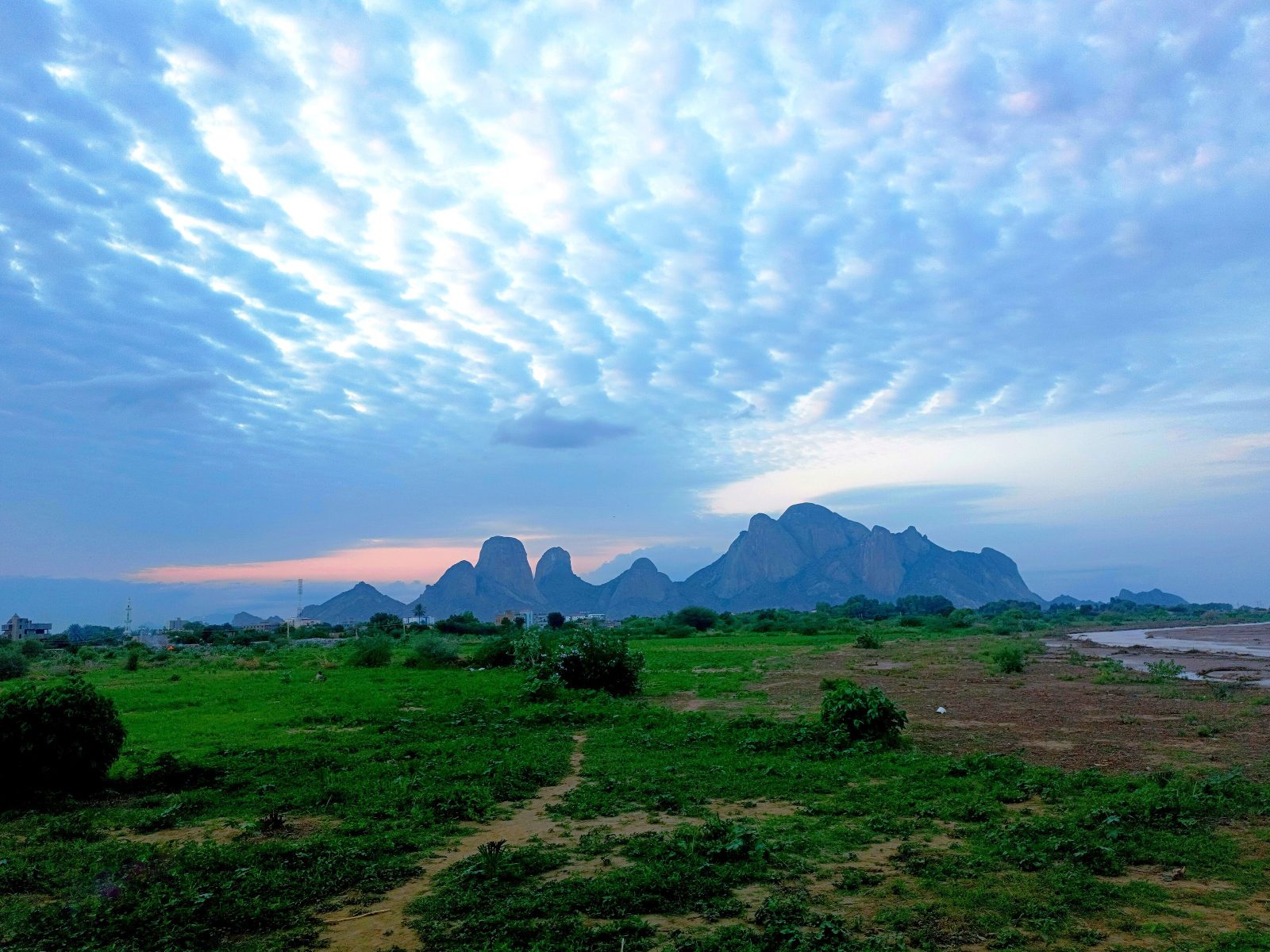
The Taka Mountains break the eastern horizon with granite domes that rise sheer from the savannah — a crossroads of culture, water and song.

Taka Granite domes·Gash River·Totil Spring

Granite domes, an inland river, and a promise to return.

The dramatic Taka Mountains rise abruptly from the savannah as the backdrop to Kassala, a historic cultural crossroads near the eastern frontier.

The river that never reaches the sea

The seasonal Gash is an endorheic river — it never empties into any ocean, instead terminating in an inland delta, creating a fertile sanctuary of fruit orchards amid the semi-arid plains.

Whoever drinks of its pure waters is destined to return to Kassala.The legend of the Totil Spring

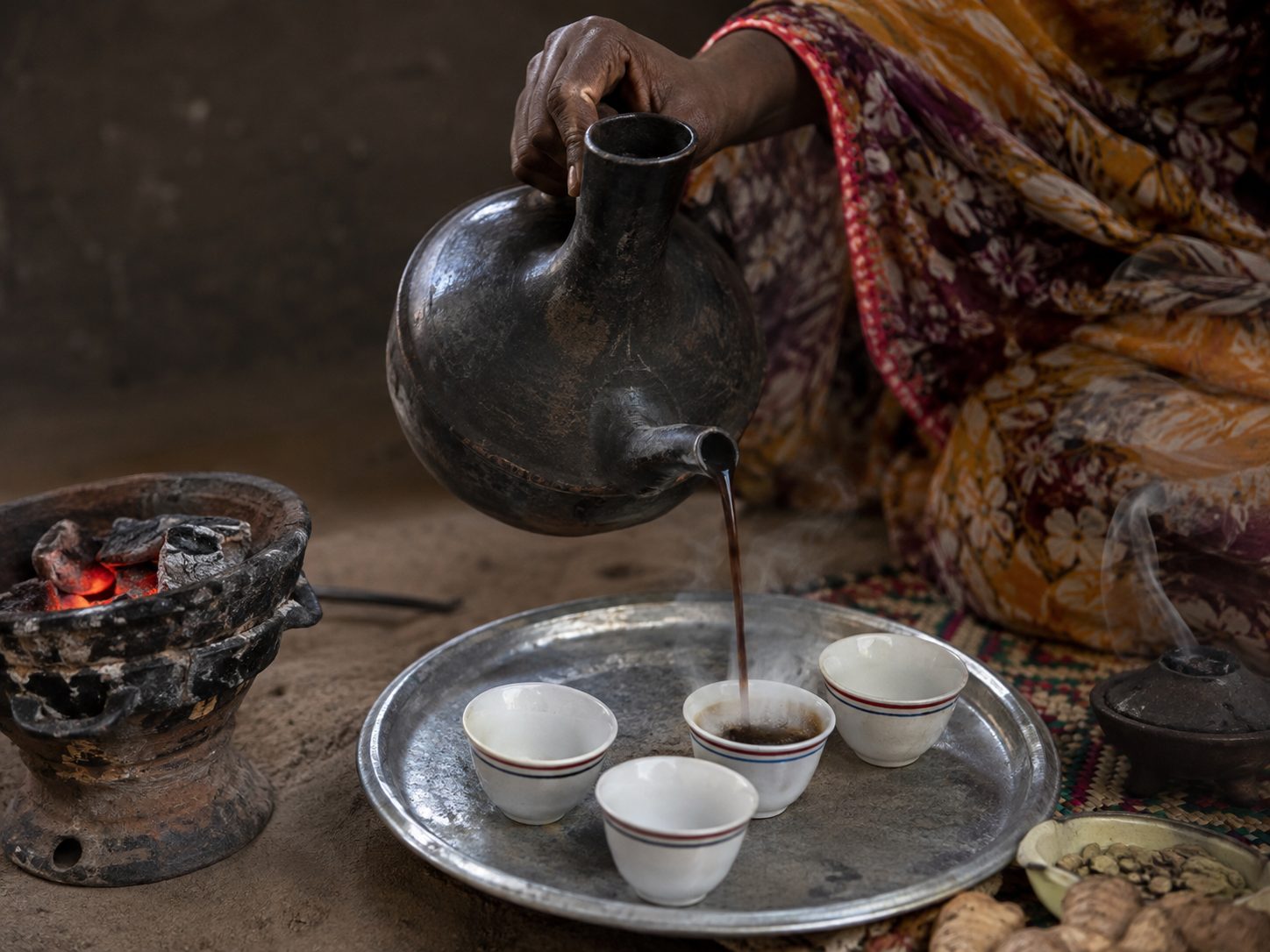
The region's heritage lives in the elaborate jebena coffee ceremony and the sword dances of the Beja, whose synchronised movements display a fierce, independent martial history.

V — Chapter Five

The Sunken Citadel of Suakin.

A perfectly circular island in a Red Sea inlet — a masterwork of coral-stone engineering, and Africa's gateway to the wider world.

Coral Island·Roshan Casements·Red Sea

A city cut entirely from the living reef.

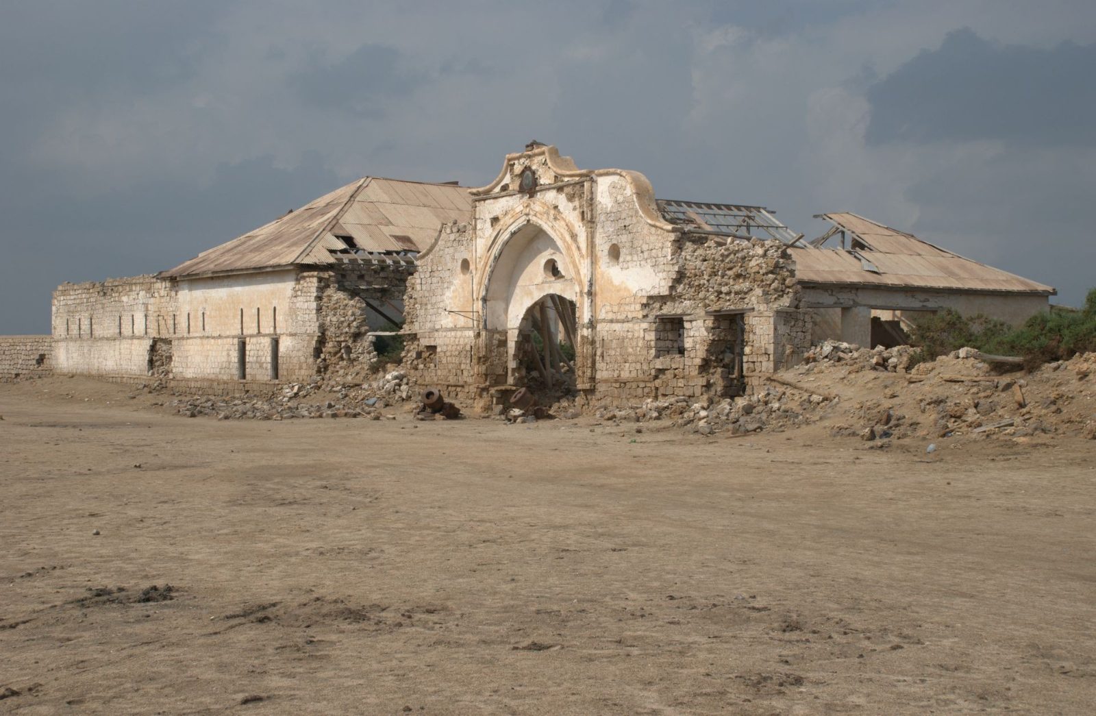
On a perfectly circular island in a protected Red Sea inlet, Suakin was for millennia the gateway connecting the African interior with the Indian Ocean, the Mediterranean, and the pilgrimage routes to Mecca.

Red Sea architecture

Every house, mosque and public building was built entirely of hand-cut madrepore coral quarried from the sea-bed, coated in sun-reflecting white lime, and fitted with carved teak casement windows called Roshan.

A sovereign coastal fortress where African, Ottoman and Indian maritime legacies merged.The sea-gates of Suakin

Though the coral structures now rest in evocative ruins, the documentation of its sea-gates and submerged wrecks reveals a dense, multi-layered history.

VI — Chapter Six

Hands of the People.

The kingdoms ended; the craft did not. The jebena pot, the woven tabag, the painted door and bridal henna carry the archive forward, hand to hand.

The Meroitic script

We can read it. We cannot understand it.

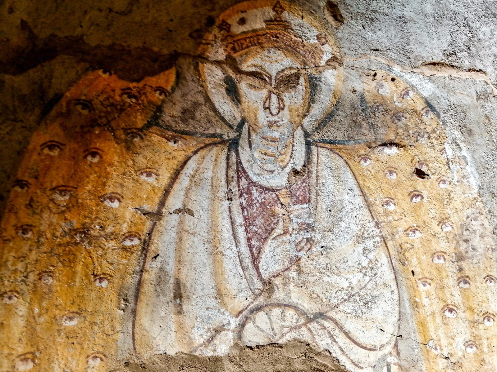
Around the 3rd century BC the scribes of Kush stopped borrowing and invented a script of their own — 23 signs, one of the earliest writing systems in sub-Saharan Africa. It ran right to left, exactly as Arabic runs on this page.

Kush had written in Egyptian hieroglyphs for centuries. Then, in about the 3rd century BC, its scribes built something of their own: two scripts for one language — a hieroglyphic form for monuments and temple walls, and a flowing cursive for everyday writing, on papyrus, parchment, potsherds and ostraca. The cursive did the daily work; the hieroglyphs did the ceremony.

Twenty-three signs, and one invention

Each script carries 23 signs: 15 consonants, 4 vowels — one of them only ever appearing at the start of a word — and 4 syllable signs, for ne, se, te and to. Texts ran right to left, and sometimes vertically.

And Meroitic did something almost no ancient script did: it marked where one word ended and the next began, with a separator resembling a colon. Egyptian hieroglyphs ran unbroken. Greek ran unbroken. Kush wrote with the equivalent of spaces, more than two thousand years ago.

Deciphered, and still silent

In 1909 the British archaeologist Francis Llewellyn Griffith found the key — a stand bearing the names of Meroitic rulers in both Meroitic and Egyptian hieroglyphs. From it he matched the two Meroitic scripts to each other and to sound. Every sign can now be pronounced.

What is still missing is meaning. There is no Rosetta Stone for Meroitic — no long bilingual text against a language we know. So a few thousand surviving inscriptions can be read aloud and only partly understood: royal names, gods, titles, borrowed Egyptian words. The linguist Claude Rilly has since placed Meroitic in the Northern Eastern Sudanic branch of Nilo-Saharan, alongside Nubian, Nara, Tama and Nyimang — which is slowly opening the vocabulary from the side.

It is, in the most literal sense, a living archive still waiting to be read.
Sources: Britannica, Meroitic language — the 23 signs, Griffith's decipherment from the funerary texts, and the right-to-left direction · Claude Rilly, The Meroitic Language and Writing System (Cambridge) — the Northern Eastern Sudanic classification · R. Smith, "Constructing word similarities in Meroitic as an aid to decipherment," British Museum Studies in Ancient Egypt and Sudan — the word separator and the absence of a bilingual key · Unicode Consortium, Meroitic Hieroglyphs chart.

The Record

Six things Sudan did first.

Every claim on this page is sourced. Where scholarship disagrees, we say so and give the range. Follow any citation to the primary record.

c. 2500 BC · Kerma

A city on the Nile, standing on its own

UNESCO records Kerma as the capital of the first Kingdom of Kush and the site of one of the earliest urban centres in sub-Saharan Africa, flourishing between 2500 and 1500 BC and reaching from the 1st to the 5th cataract. By 1700 BC the city held a population of at least 10,000, with roads, a palace, an audience hall and workshops.

UNESCO World Heritage Tentative List, Monuments of the Kingdom of Kermawhc.unesco.org/en/tentativelists/6594 · Swiss-Franco-Sudanese Archaeological Mission, Kerma–Dukki Gel

c. 1750 BC · The Western Deffufa

Monumental architecture in mud brick

The Western Deffufa is described as one of the oldest known monumental structures in the Nile Valley — built entirely of sun-dried mudbrick, rising roughly 18 to 20 metres, with interior chambers and courtyards for ritual. Kerma's craftsmen developed their own techniques for blue faience and glazed quartzite.

Wikipedia, Western Deffufa (c. 2500 BC, ~20 m) — en.wikipedia.org/wiki/Western_Deffufa · Archaeology Magazine, "A Nubian Kingdom Rises," Sept/Oct 2020 (65 ft)

21 BC · Treaty of Samos

Amanirenas and Rome: a war that ended in a favourable settlement

Between 25 and 22 BC Kush fought Rome along the southern frontier of Roman Egypt. Strabo, writing in his Geography, records that the envoys of the Kandake "obtained everything they pled for," and that Augustus remitted the tribute he had imposed — terms settled at Samos that held for some three centuries. Strabo names the ruler only by the title Candace; modern scholarship commonly identifies her as Amanirenas, an interpretation rather than a fact of the text.

Strabo, Geography Book XVII · Wikipedia, Amanirenasen.wikipedia.org/wiki/Amanirenas · HISTORY, "The Nubian Queen Who Fought Back Caesar's Army"

652 AD · Old Dongola

The Baqt: centuries of negotiated coexistence

The Nubian kingdom of Makuria turned back an Arab army at Dongola in 642 and again in 652 — Muslim chroniclers singled out the skill of the Nubian archers. Rather than conquest, the two powers entered the Baqt: an exchange of goods and mutual non-aggression, conventionally dated to 652, which evolved over roughly six to seven centuries. No original text of the agreement survives and later accounts differ on its terms.

Ibn Abd al-Hakam, Futuh Misr · Wikipedia, Baqten.wikipedia.org/wiki/Baqt · Wikipedia, Kingdom of Makuria

Inscribed 2011 · Island of Meroë

The royal necropolises of Meroë

Meroë's royal necropolises contain more than 200 graves, many of them marked by the steep-sided pyramids that became an emblem of Kush. UNESCO inscribed the Island of Meroë in 2011 as the heartland of Kush, a major power from the 8th century BC to the 4th century AD. The pyramids are markedly steeper and narrower than most, the tallest about 30 m. Note that graves and standing pyramids are not interchangeable counts.

UNESCO ref 1336 and ICOMOS evaluation — whc.unesco.org/document/152412 · UNESCO ref 1336 — whc.unesco.org/en/list/1336

1504 – 1821 · Sennar

The Funj Sultanate, a state in its own right

For three centuries the Funj Sultanate, centred on Sennar on the Blue Nile, held together a state that linked the Red Sea trade routes, the Ethiopian highlands and the wider Sahel. Its court, its scholars and its long accommodation with the Abdallab of the north make it a major chapter of Sudanese history — not an interval between ancient Kush and modern rule.

UNESCO, General History of Africa III — unesdoc.unesco.org · Cambridge World History, Africa: States, Empires, and Connections

Inscribed 2016 · Sanganeb & Dungonab

The Red Sea’s only atoll-like feature

UNESCO describes Sanganeb as the only atoll-like feature in the Red Sea — not an atoll in the strict sense — lying 25 km offshore, ringed by water 800 m deep, with 13 bio-physiographic reef zones and over 300 fish species. Dungonab Bay, 125 km north of Port Sudan, holds a globally significant population of dugongs. It remains the first and only World Heritage site in the Red Sea.

UNESCO ref 262 — whc.unesco.org/en/list/262 · IUCN World Heritage Outlook · UNEP-WCMC World Heritage Datasheet

Sources consulted