The Nile threading the great S-bend of Nubia

Der Atlas

Achtzehn Staaten. Ein Sudan.

Von den Pyramiden des Flussnordens zu den Granitkuppeln des Ostens, dem Vulkan des Westens und den Feuchtgebieten des Südens — das ganze Land, Staat für Staat.

I

Die Nordregion

Der Korridor der Königreiche — wo der Nil sich durch Nubien windet.

Hauptstadt · Dongola

Nordstaat

  • Jebel Barkal — the sacred flat-topped mountain and its Kushite temples.
  • Kerma (Deffufa) — towering mud-brick monuments of Africa's oldest urban civilisation.
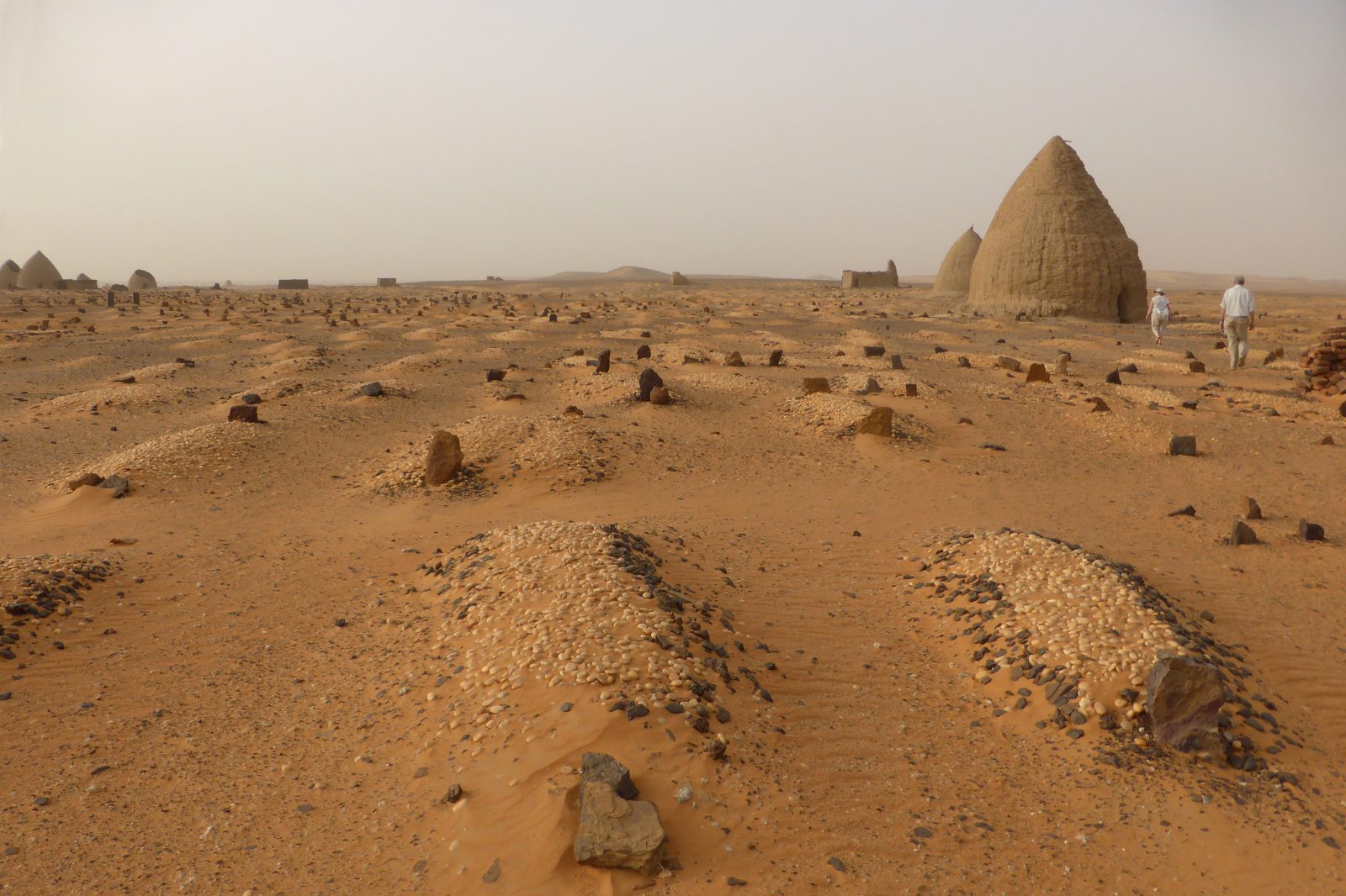
  • Old Dongola — ruined capital of Christian Makuria, throne hall and qubbas.
  • Soleb Temple — sandstone temple raised by Amenhotep III.
  • Sai Island — remains from the Stone Age to Ottoman times on one Nile island.
  • Merowe Dam — the "Great Wall of the Nile" at the fourth cataract, 1,250 MW.

Hauptstadt · Ed Damer

Nilstaat

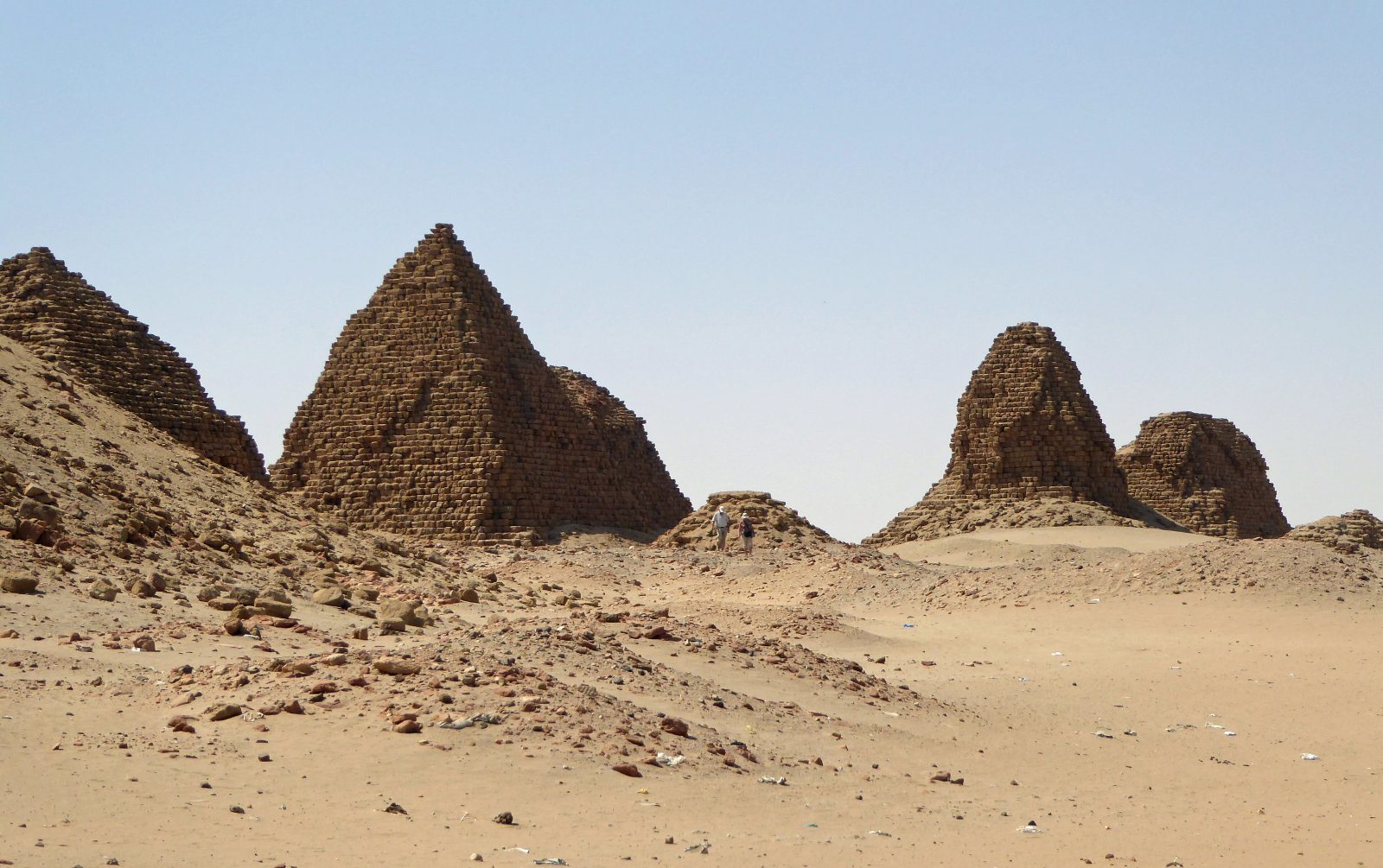
  • Pyramids of Meroë — 200+ steep royal pyramids in the dunes; Sudan's icon.
  • Musawwarat es-Sufra — the Great Enclosure and its elephant carvings.
  • Naqa — the Lion Temple and a Roman-style kiosk, perfectly preserved.
  • Sabaloka Gorge — the Nile narrowing through volcanic rock; boat country.
II

Die Ostregion

Korallenmeere, Granitkuppeln und grüne Sturzbäche im Schatten der Wüste.

Hauptstadt · Port Sudan

Rotmeer-Staat

  • Sanganeb Marine Park — a coral atoll with its British-built lighthouse.
  • Port Sudan reefs — pristine walls, hammerheads in season.
  • Suakin Island — a port town built entirely of coral blocks.
  • Dungonab Bay — UNESCO sanctuary of dugongs and sea turtles.
  • The Umbria wreck — one of the world's great WWII wreck dives.

Hauptstadt · Kassala

Kassala-Staat

  • Taka Mountains — smooth granite domes towering over the city.
  • Khatmiya Mosque — the Sufi shrine at the mountains' foot.
  • Gash River orchards — fruit groves fed by seasonal torrents.
  • Khashm el-Girba & Upper Atbara dams — the waters of New Halfa.

Hauptstadt · Gedaref

Al-Qadarif-Staat

  • Dinder National Park (north) — biosphere of birds, antelope and baboon.
  • Gedaref sesame markets — one of Africa's greatest open-air grain hubs.
II · i

Halayeb und Schalatin.

Sudans Nordostküste — 20.580 km² Rotmeerküste, Berge und Beja-Weideland.

Where the Red Sea coast runs north from Port Sudan, the shore does not stop at a line of latitude. It carries on through Abu Ramad, the port of Halayeb and the settlement of Shalateen — a stretch of mountain, wadi and coral coast that has belonged to the Beja for as long as anyone has counted.

Two lines on a colonial map

In 1899 the Anglo-Egyptian Condominium Agreement drew a political boundary straight along the 22nd parallel north — a surveyor's line, indifferent to who actually lived there. Three years later, on 4 November 1902, Britain drew a second line: an administrative boundary intended to reflect the real use of the land by the tribes of the region.

That 1902 line placed the territory north of the parallel — the grazing lands of the Bishareen, a Beja sub-tribe — under Sudanese administration, because the people there belonged to Sudan's east and answered to the governor in Khartoum, not Cairo. Sudan has held to the 1902 boundary ever since independence in 1956, and in its own claim and official presentation the area belongs to Red Sea State. Egypt has exercised de facto administration since the mid-1990s.

A land of the Beja

The case was never really about cartography. It is about kinship. The Bishareen and Ababda who live between Halayeb and Shalateen are the same Beja people who fill the markets of Port Sudan and Kassala, speak the same Tu-Bedawie, herd the same camels, and carry the same swords at the same weddings. Around 24,000 people live at Shalateen alone.

It is austere, dramatic country: granite peaks rising off the water, Mount Shendib at 1,911 metres, seasonal wadis running green after rain, and a coral coastline continuous with the reefs of Sanganeb and Dungonab to the south.

Where the matter stands

Egypt asserts the 1899 parallel and has exercised de facto control since the mid-1990s. Sudan maintains the 1902 administrative boundary and has consistently called for the question to be settled by international arbitration — the ordinary, lawful means of resolving such a claim between neighbours. This archive maps the territory as Sudanese, on the 1902 line, and states the position plainly.

Sources: Anglo-Egyptian Condominium Agreement, 1899, and the British administrative boundary of 4 November 1902 · Wikipedia, Halaib Triangle and Shalateen · CIA, Sudan — Administrative Divisions map, which carries the note: "Sudan claims but Egypt de facto administers security and economic development of the Hala'ib Triangle north of the 22nd parallel boundary" · WorldAtlas, The Egypt–Sudan Border Dispute.
III

Die Mitte

Wo die beiden Nile heiraten und die Kornkammer sich dazwischen ausbreitet.

Hauptstadt · Khartum

Khartum-Staat

  • National Museum of Sudan — salvaged temples, the great Nubian collections.
  • Al-Mogran — the exact point where Blue and White Nile merge.
  • Hamed el-Nil — Friday's whirling dervishes in Omdurman.
  • Omdurman souk — leather, silver, spice; the old market of markets.
  • Tuti Island — a green farming island at the capital's heart.
  • Jebel Aulia Dam — the 1937 regulator of the White Nile.

Hauptstadt · Wad Madani

Al-Gezira-Staat

  • Wad Medani waterfront — tree-lined Blue Nile promenades at sunset.
  • Gezira Scheme — one of Earth's largest integrated irrigation networks.
  • Abu Haraz qubbas — pyramid-pointed Sufi tombs in sky blue, pink and green.
  • Souq Wad Medani — produce mountains, spice, hand-woven cloth.
IV

Die Westregion — Darfur

Fünf Staaten um einen grünen Vulkan — Obstgärten in der Höhe, Sultanspaläste, Zitrustäler.

Hauptstadt · El Fasher

Nord-Darfur

  • Jebel Marra (north slopes) — volcanic peaks, cool orchards, waterfalls.
  • Ali Dinar Palace Museum — the last sultan's residence and armoury.

Hauptstadt · Nyala

Süd-Darfur

  • Wadi Nyala markets — one of Africa's great livestock exchanges.
  • Radom National Park — seasonal wetlands and woodland savanna.

Hauptstadt · El Geneina

West-Darfur

  • Geneina sultanate ruins — strongholds of the Masalit kingdom.

Hauptstädte · Ed Daein & Zalingei

Ost- & Zentral-Darfur

  • Ad Daein savanna — pastoral plains of the Rizeigat herders.
  • Zalingei valleys — Sudan's finest citrus, grown in volcanic soil.
V

Kordofan & der große Süden

Land des Gummiarabikums, Ringer-Berge und die Insel, auf der eine Revolution begann.

Hauptstädte · El Obeid, Kadugli, El Fula

Die drei Kordofans

  • Nuba Mountains — terraced granite hills, festivals and wrestling.
  • El Obeid Cathedral — the great red-brick cathedral of 1920s Kordofan.
  • Gum arabic souks — the world's trading floor for acacia gold.
  • Lake Kundi — seasonal sanctuary for rare migratory birds.

Hauptstädte · Ad Damazin, Rabak, Singa

Blauer Nil · Weißer Nil · Sennar

  • Roseires Dam — the reservoir anchor of Sudan's power grid since 1966.
  • Ingessana Hills — geologically unique hills, living traditions.
  • Aba Island — birthplace of the Mahdist movement on the White Nile.
  • Kosti port — barges loading for the far south.
  • Sennar Dam — the 1925 stone dam that feeds the Gezira Scheme.
  • Old Sennar — ruins of the Funj Sultanate, the Black Sultanate.
VI

Die Wasser Sudans

Sechs große Dämme halten die Flüsse — Energie, Ernte und die langsame Ingenieurskunst eines Jahrhunderts.

Main Nile · 2009

Merowe Dam

The "Great Wall of the Nile" at the fourth cataract — 1,250 MW, Sudan's largest hydropower work.

Blue Nile · 1966 / 2013

Roseires Dam

Heightened in 2013; the reservoir that anchors Sudan's power and feeds the Kenana and Dinder canals.

Blue Nile · 1925

Sennar Dam

The oldest monument of them all — British-built stone, still watering the Gezira Scheme by gravity.

White Nile · 1937

Jebel Aulia Dam

Forty kilometres south of the capital — the quiet regulator of the White Nile's seasons.

Atbara & Setit · 2017

Upper Atbara Complex

The twin Rumela and Burdana dams — 320 MW and new farmland for the east.

Atbara · 1964

Khashm el-Girba

The reservoir of the New Halfa scheme — built for the families of drowned Wadi Halfa.

VII

Drei Wunder

Ein Löwentempel, ein Leuchtturm auf einem Korallenatoll und eine Wasserstelle, an der die älteste Tierwelt des Nils noch trinkt.

The Lion Temple of Apedemak at Naqa

Nilstaat

Naqa

Der Löwentempel des Apedemak steht neben einem römischen Kiosk — zwei Reiche auf einer Lichtung der meroitischen Wüste.

The lighthouse on Sanganeb atoll in the Red Sea

Rotmeer-Staat

Sanganeb

Ein Leuchtturm auf einem Ring lebenden Korallenriffs, vierzig Kilometer vor der Küste — Sudans erste UNESCO-Meeresstätte.

Waterbuck and storks at a Dinder National Park waterhole

Sennar & Al Qadarif

Dinder

An den Wasserstellen der Trockenzeit in Sudans ältestem Nationalpark teilen sich Wasserböcke, Marabus und Reiher einen Tümpel.

VIII

Die alten Hauptstädte

The royal pyramids at Nuri near Napata

750 BC – 350 AD · Kush

Napata & Meroë

The twin capitals of the Kingdom of Kush — Napata the spiritual seat beneath the holy mountain where pharaohs were crowned, Meroë the royal city whose steep pyramids still hold the eastern dunes.

The Throne Hall and qubbas of Old Dongola

6th – 14th century · Makuria

Old Dongola

The cosmopolitan Nubian metropolis of Christian Makuria — its ninth-century Throne Hall became a mosque in 1317, and its pyramidal qubbas still stand over the river road.

Ali Dinar Palace · El Fasher

Photograph coming soonالصورة قريباً

18th – 20th century · Darfur

El Fasher

Seat of the independent Darfur Sultanate and hub of the trans-Saharan caravans — the Ali Dinar Palace Museum keeps the memory of the region's last sovereign ruler.

Sufi qubbas · Abu Haraz

Photograph coming soonالصورة قريباً

Al Gezira · living shrine

Abu Haraz

On the Blue Nile east of Wad Medani, pyramid-pointed Sufi qubbas painted sky blue, pink and green — where ancient Nubian geometry and Islamic devotion share one silhouette.

Sudan’s 18 states

The states of Sudan are: Northern; River Nile; Red Sea; Kassala; Gedaref; Khartoum; Gezira; Sennar; White Nile; Blue Nile; North Kordofan; South Kordofan; West Kordofan; North Darfur; South Darfur; West Darfur; Central Darfur; East Darfur.