Les Chroniques

Une civilisation africaine indépendante.

Six chapitres, racontés selon les termes du Soudan — des flèches de brique de Kerma à la citadelle de corail de Suakin.

I — Chapitre Un

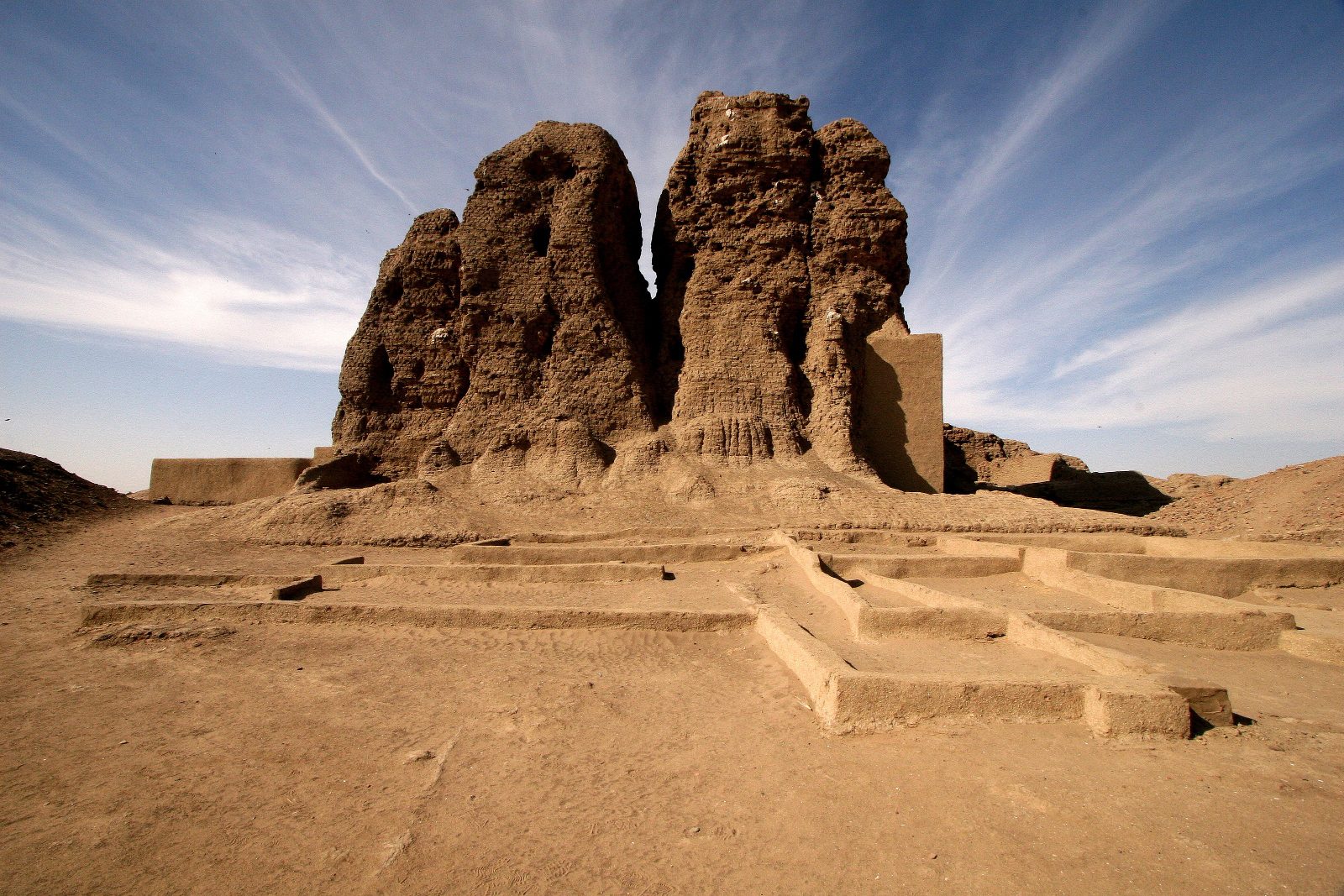
Les flèches souveraines de Kerma.

·18 m Deffufa·1,000 yr Sovereign

II — Chapitre Deux

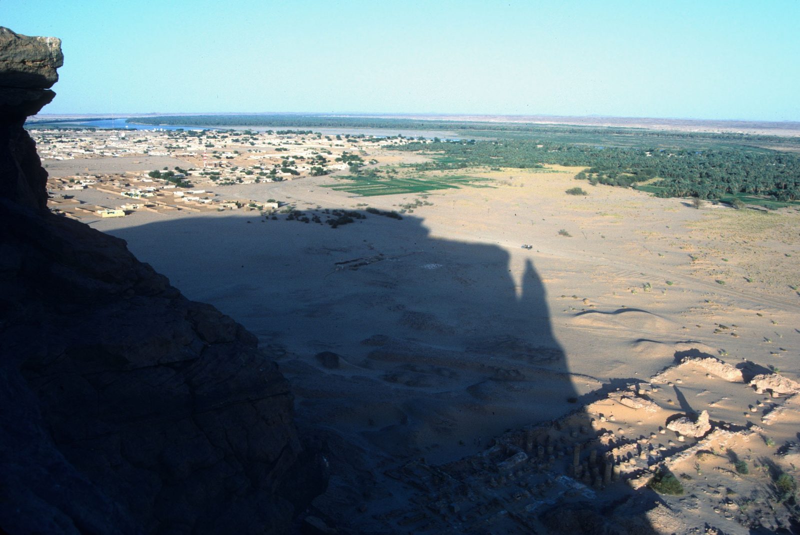
Les sentinelles de granite de Barkal.

·Napata·Amun

III — Chapitre Trois

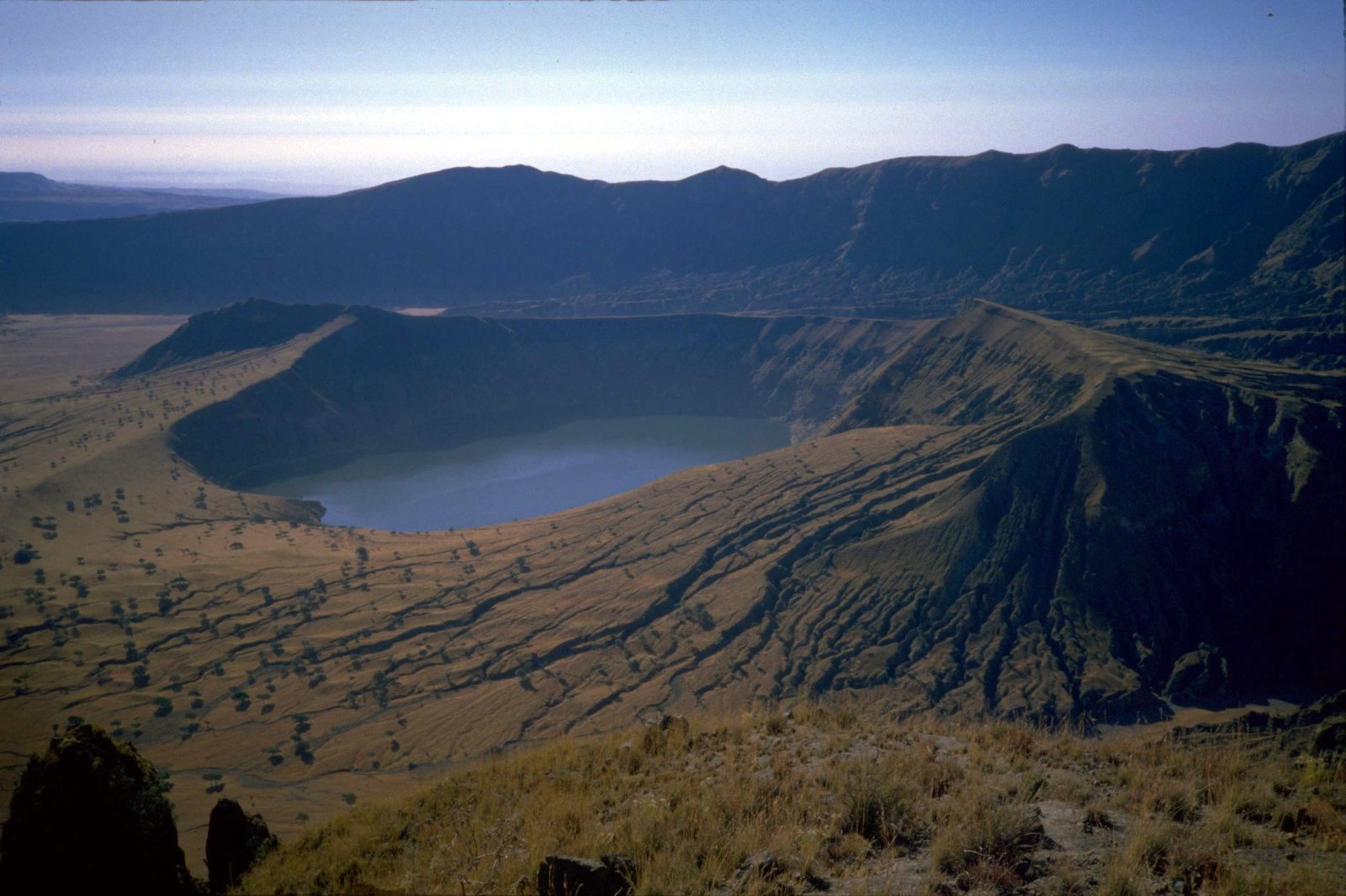
La couronne verte de l'Ouest.

·Deriba Crater lakes·Darfur

IV — Chapitre Quatre

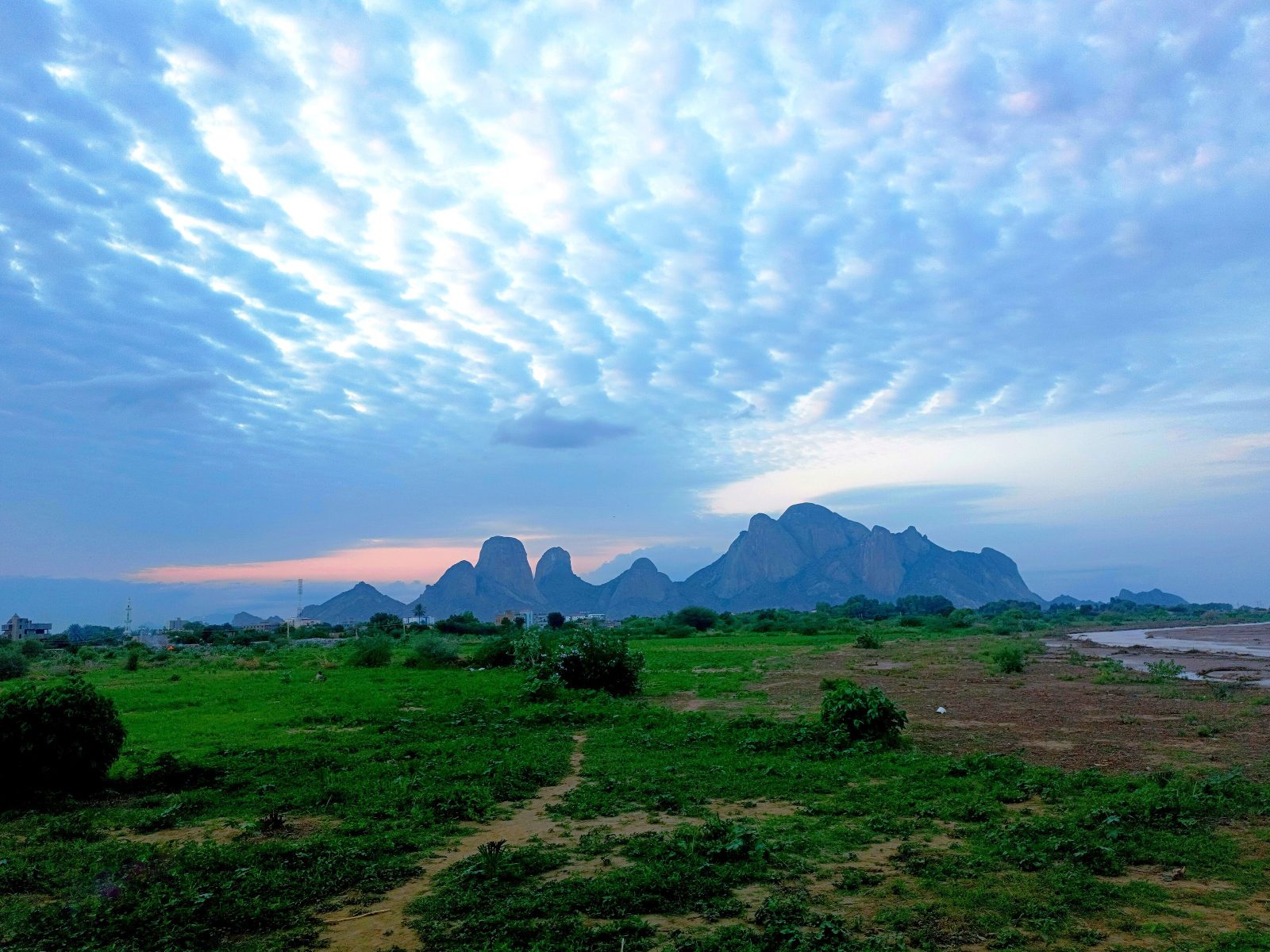
Les flèches émeraude de Kassala.

·Gash River·Totil Spring

V — Chapitre Cinq

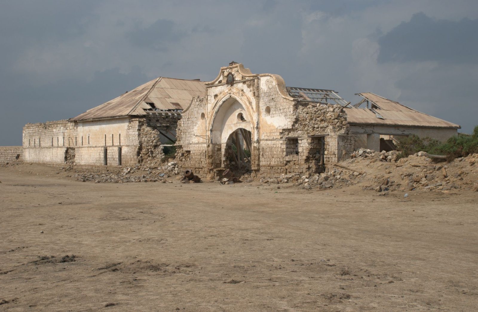
La citadelle engloutie de Suakin.

·Roshan Casements·Red Sea

VI — Chapitre Six

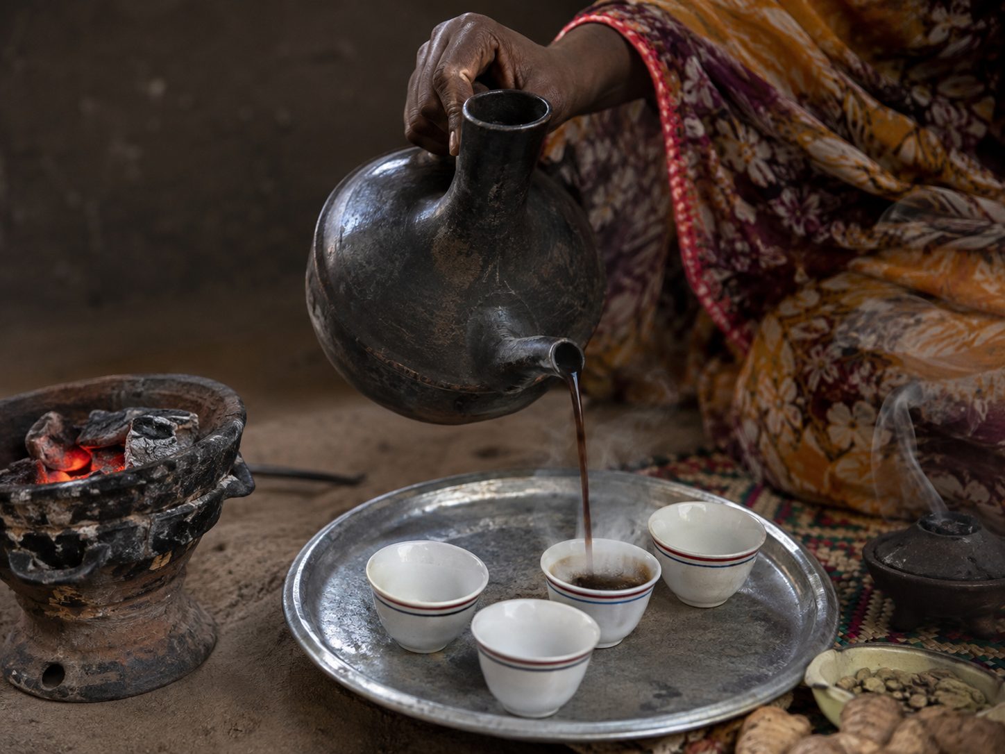
Les mains du peuple.

L'écriture méroïtique

Nous savons la lire. Nous ne la comprenons pas.

Vers le IIIe siècle av. J.-C., les scribes de Koush inventèrent leur propre écriture — 23 signes, l'un des premiers systèmes d'écriture d'Afrique subsaharienne. Elle se lisait de droite à gauche, comme l'arabe sur cette page.

Kush had written in Egyptian hieroglyphs for centuries. Then, in about the 3rd century BC, its scribes built something of their own: two scripts for one language — a hieroglyphic form for monuments and temple walls, and a flowing cursive for everyday writing, on papyrus, parchment, potsherds and ostraca. The cursive did the daily work; the hieroglyphs did the ceremony.

Twenty-three signs, and one invention

Each script carries 23 signs: 15 consonants, 4 vowels — one of them only ever appearing at the start of a word — and 4 syllable signs, for ne, se, te and to. Texts ran right to left, and sometimes vertically.

And Meroitic did something almost no ancient script did: it marked where one word ended and the next began, with a separator resembling a colon. Egyptian hieroglyphs ran unbroken. Greek ran unbroken. Kush wrote with the equivalent of spaces, more than two thousand years ago.

Deciphered, and still silent

In 1909 the British archaeologist Francis Llewellyn Griffith found the key — a stand bearing the names of Meroitic rulers in both Meroitic and Egyptian hieroglyphs. From it he matched the two Meroitic scripts to each other and to sound. Every sign can now be pronounced.

What is still missing is meaning. There is no Rosetta Stone for Meroitic — no long bilingual text against a language we know. So a few thousand surviving inscriptions can be read aloud and only partly understood: royal names, gods, titles, borrowed Egyptian words. The linguist Claude Rilly has since placed Meroitic in the Northern Eastern Sudanic branch of Nilo-Saharan, alongside Nubian, Nara, Tama and Nyimang — which is slowly opening the vocabulary from the side.

It is, in the most literal sense, a living archive still waiting to be read.
Sources: Britannica, Meroitic language — the 23 signs, Griffith's decipherment from the funerary texts, and the right-to-left direction · Claude Rilly, The Meroitic Language and Writing System (Cambridge) — the Northern Eastern Sudanic classification · R. Smith, "Constructing word similarities in Meroitic as an aid to decipherment," British Museum Studies in Ancient Egypt and Sudan — the word separator and the absence of a bilingual key · Unicode Consortium, Meroitic Hieroglyphs chart.

Le Registre

Six choses que le Soudan a faites en premier.

Chaque affirmation de cette page est sourcée. Là où les études divergent, nous le disons et donnons la fourchette.

c. 2500 BC · Kerma

A city on the Nile, standing on its own

UNESCO records Kerma as the capital of the first Kingdom of Kush and the site of one of the earliest urban centres in sub-Saharan Africa, flourishing between 2500 and 1500 BC and reaching from the 1st to the 5th cataract. By 1700 BC the city held a population of at least 10,000, with roads, a palace, an audience hall and workshops.

UNESCO World Heritage Tentative List, Monuments of the Kingdom of Kermawhc.unesco.org/en/tentativelists/6594 · Swiss-Franco-Sudanese Archaeological Mission, Kerma–Dukki Gel

c. 1750 BC · The Western Deffufa

Monumental architecture in mud brick

The Western Deffufa is described as one of the oldest known monumental structures in the Nile Valley — built entirely of sun-dried mudbrick, rising roughly 18 to 20 metres, with interior chambers and courtyards for ritual. Kerma's craftsmen developed their own techniques for blue faience and glazed quartzite.

Wikipedia, Western Deffufa (c. 2500 BC, ~20 m) — en.wikipedia.org/wiki/Western_Deffufa · Archaeology Magazine, "A Nubian Kingdom Rises," Sept/Oct 2020 (65 ft)

21 BC · Treaty of Samos

Amanirenas and Rome: a war that ended in a favourable settlement

Between 25 and 22 BC Kush fought Rome along the southern frontier of Roman Egypt. Strabo, writing in his Geography, records that the envoys of the Kandake "obtained everything they pled for," and that Augustus remitted the tribute he had imposed — terms settled at Samos that held for some three centuries. Strabo names the ruler only by the title Candace; modern scholarship commonly identifies her as Amanirenas, an interpretation rather than a fact of the text.

Strabo, Geography Book XVII · Wikipedia, Amanirenasen.wikipedia.org/wiki/Amanirenas · HISTORY, "The Nubian Queen Who Fought Back Caesar's Army"

652 AD · Old Dongola

The Baqt: centuries of negotiated coexistence

The Nubian kingdom of Makuria turned back an Arab army at Dongola in 642 and again in 652 — Muslim chroniclers singled out the skill of the Nubian archers. Rather than conquest, the two powers entered the Baqt: an exchange of goods and mutual non-aggression, conventionally dated to 652, which evolved over roughly six to seven centuries. No original text of the agreement survives and later accounts differ on its terms.

Ibn Abd al-Hakam, Futuh Misr · Wikipedia, Baqten.wikipedia.org/wiki/Baqt · Wikipedia, Kingdom of Makuria

Inscribed 2011 · Island of Meroë

The royal necropolises of Meroë

Meroë's royal necropolises contain more than 200 graves, many of them marked by the steep-sided pyramids that became an emblem of Kush. UNESCO inscribed the Island of Meroë in 2011 as the heartland of Kush, a major power from the 8th century BC to the 4th century AD. The pyramids are markedly steeper and narrower than most, the tallest about 30 m. Note that graves and standing pyramids are not interchangeable counts.

UNESCO ref 1336 and ICOMOS evaluation — whc.unesco.org/document/152412 · UNESCO ref 1336 — whc.unesco.org/en/list/1336

1504 – 1821 · Sennar

The Funj Sultanate, a state in its own right

For three centuries the Funj Sultanate, centred on Sennar on the Blue Nile, held together a state that linked the Red Sea trade routes, the Ethiopian highlands and the wider Sahel. Its court, its scholars and its long accommodation with the Abdallab of the north make it a major chapter of Sudanese history — not an interval between ancient Kush and modern rule.

UNESCO, General History of Africa III — unesdoc.unesco.org · Cambridge World History, Africa: States, Empires, and Connections

Inscribed 2016 · Sanganeb & Dungonab

The Red Sea’s only atoll-like feature

UNESCO describes Sanganeb as the only atoll-like feature in the Red Sea — not an atoll in the strict sense — lying 25 km offshore, ringed by water 800 m deep, with 13 bio-physiographic reef zones and over 300 fish species. Dungonab Bay, 125 km north of Port Sudan, holds a globally significant population of dugongs. It remains the first and only World Heritage site in the Red Sea.

UNESCO ref 262 — whc.unesco.org/en/list/262 · IUCN World Heritage Outlook · UNEP-WCMC World Heritage Datasheet

Sources consultées