The Nile threading the great S-bend of Nubia

El Atlas

Dieciocho estados. Un solo Sudán.

De las pirámides del norte fluvial a las cúpulas de granito del este, del volcán del oeste a los humedales del sur — todo el país, estado por estado.

I

La región del Norte

El corredor de los reinos — donde el Nilo serpentea por Nubia.

Capital · Dongola

Estado del Norte

Capital · Ed Damer

Estado del Nilo

II

La región del Este

Mares de coral, cúpulas de granito, torrentes verdes a la sombra del desierto.

Capital · Puerto Sudán

Estado del Mar Rojo

Capital · Kassala

Estado de Kassala

Capital · Gedaref

Estado de Al Qadarif

II · i

Halayeb y Shalateen.

La costa nororiental de Sudán — 20.580 km² de litoral, montaña y pastos beja.

Where the Red Sea coast runs north from Port Sudan, the shore does not stop at a line of latitude. It carries on through Abu Ramad, the port of Halayeb and the settlement of Shalateen — a stretch of mountain, wadi and coral coast that has belonged to the Beja for as long as anyone has counted.

Two lines on a colonial map

In 1899 the Anglo-Egyptian Condominium Agreement drew a political boundary straight along the 22nd parallel north — a surveyor's line, indifferent to who actually lived there. Three years later, on 4 November 1902, Britain drew a second line: an administrative boundary intended to reflect the real use of the land by the tribes of the region.

That 1902 line placed the territory north of the parallel — the grazing lands of the Bishareen, a Beja sub-tribe — under Sudanese administration, because the people there belonged to Sudan's east and answered to the governor in Khartoum, not Cairo. Sudan has held to the 1902 boundary ever since independence in 1956, and in its own claim and official presentation the area belongs to Red Sea State. Egypt has exercised de facto administration since the mid-1990s.

A land of the Beja

The case was never really about cartography. It is about kinship. The Bishareen and Ababda who live between Halayeb and Shalateen are the same Beja people who fill the markets of Port Sudan and Kassala, speak the same Tu-Bedawie, herd the same camels, and carry the same swords at the same weddings. Around 24,000 people live at Shalateen alone.

It is austere, dramatic country: granite peaks rising off the water, Mount Shendib at 1,911 metres, seasonal wadis running green after rain, and a coral coastline continuous with the reefs of Sanganeb and Dungonab to the south.

Where the matter stands

Egypt asserts the 1899 parallel and has exercised de facto control since the mid-1990s. Sudan maintains the 1902 administrative boundary and has consistently called for the question to be settled by international arbitration — the ordinary, lawful means of resolving such a claim between neighbours. This archive maps the territory as Sudanese, on the 1902 line, and states the position plainly.

Sources: Anglo-Egyptian Condominium Agreement, 1899, and the British administrative boundary of 4 November 1902 · Wikipedia, Halaib Triangle and Shalateen · CIA, Sudan — Administrative Divisions map, which carries the note: "Sudan claims but Egypt de facto administers security and economic development of the Hala'ib Triangle north of the 22nd parallel boundary" · WorldAtlas, The Egypt–Sudan Border Dispute.
III

Los centros del medio

Donde los dos Nilos se casan, y el granero se extiende entre ellos.

Capital · Jartum

Estado de Jartum

Capital · Wad Medani

Estado de Al Gezira

IV

La región Oeste — Darfur

Cinco estados alrededor de un volcán verde — huertos de altura, palacios de sultanes, valles de cítricos.

Capital · El Fasher

Darfur del Norte

Capital · Nyala

Darfur del Sur

Capital · El Geneina

Darfur del Oeste

Capitales · Ed Daein y Zalingei

Darfur Este y Central

V

Kordofán y el Gran Sur

País de la goma arábiga, montañas de lucha, y la isla donde empezó una revolución.

Capitales · El Obeid, Kadugli, El Fula

Los tres Kordofanes

Capitales · Ad Damazin, Rabak, Singa

Nilo Azul · Nilo Blanco · Sennar

VI

Las aguas de Sudán

Seis grandes presas sostienen los ríos — energía, cosecha y la lenta ingeniería de un siglo.

VII

Tres maravillas

Un templo de leones, un faro en un atolón de coral, y un abrevadero donde la fauna más antigua del Nilo aún viene a beber.

The Lion Temple of Apedemak at Naqa

Estado del Nilo

Naqa

El Templo del León de Apedemak se alza junto a un quiosco de estilo romano — dos imperios en un mismo claro del desierto meroítico.

The lighthouse on Sanganeb atoll in the Red Sea

Estado del Mar Rojo

Sanganeb

Un faro sobre un anillo de coral vivo, a cuarenta kilómetros de la costa — el primer sitio marino sudanés de la UNESCO.

Waterbuck and storks at a Dinder National Park waterhole

Sennar y Al Qadarif

Dinder

En los abrevaderos de la estación seca del parque nacional más antiguo de Sudán, antílopes, marabúes y garzas comparten una misma charca.

VIII

Las viejas capitales

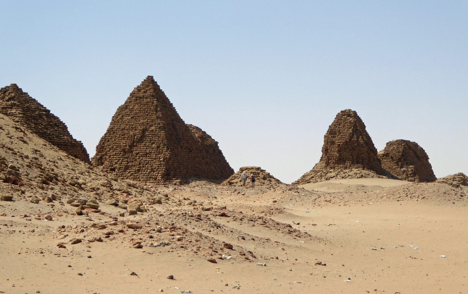
The royal pyramids at Nuri near Napata
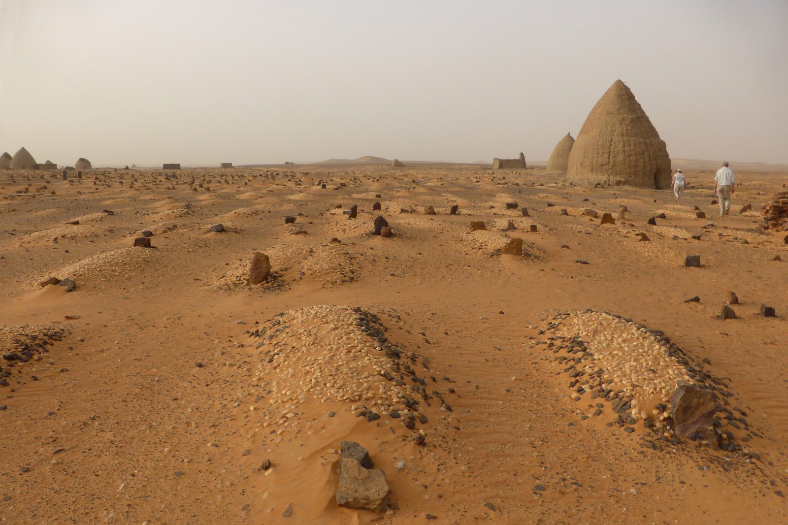
The Throne Hall and qubbas of Old Dongola

Ali Dinar Palace · El Fasher

Photograph coming soonالصورة قريباً

Sufi qubbas · Abu Haraz

Photograph coming soonالصورة قريباً