The ChroniclesالفصولLes ChroniquesLas CrónicasDie Chroniken

An independent African civilisation. حضارةٌ أفريقيّةٌ مستقلّة. Une civilisation africaine indépendante. Una civilización africana independiente. Eine unabhängige afrikanische Zivilisation.

Six chapters, told on Sudan's own terms — from the mudbrick spires of Kerma to the coral citadel of Suakin, and the living hands between. ستّةُ فصول، تُروى على شروطِ السودانِ هو — من صروحِ كرمةَ الطينيّةِ إلى قلعةِ سواكنَ المرجانيّة، والأيادي الحيّةِ بينهما. Six chapitres, racontés selon les termes du Soudan — des flèches de brique de Kerma à la citadelle de corail de Suakin. Seis capítulos, contados en los términos de Sudán — de las agujas de barro de Kerma a la ciudadela de coral de Suakin. Sechs Kapitel, zu Sudans eigenen Bedingungen erzählt — von den Lehmziegeltürmen Kermas zur Korallenzitadelle Suakins.

I — Chapter Oneالفصل الأولChapitre UnCapítulo UnoKapitel Eins

The Sovereign Spires of Kerma.صروحُ كرمة ذاتِ السيادة.Les flèches souveraines de Kerma.Las agujas soberanas de Kerma.Die souveränen Türme von Kerma.

From 2500 BC, one of Africa's earliest and most formidable independent urban civilisations — risen entirely on its own genius above the Third Cataract.منذ 2500 قبل الميلاد، واحدةٌ من أقدمِ وأقوى الحضاراتِ الحضريّةِ المستقلّةِ في أفريقيا — قامت بعبقريّتها وحدها فوقَ الشلّالِ الثالث.

2500 BC Founded2500 ق.م التأسيس·18 m Deffufa·1,000 yr Sovereign

A city of mudbrick that ruled for a thousand years.مدينةٌ من الطّوبِ اللَّبِنِ حكمت ألفَ عام.

Rising above the fertile plains of the Third Cataract, Kerma developed its architectural and political zenith entirely outside any external imperial sphere. The capital was engineered with specialised residential quarters, bronze-forging complexes, and workshops for blue faience and glazed quartzite.

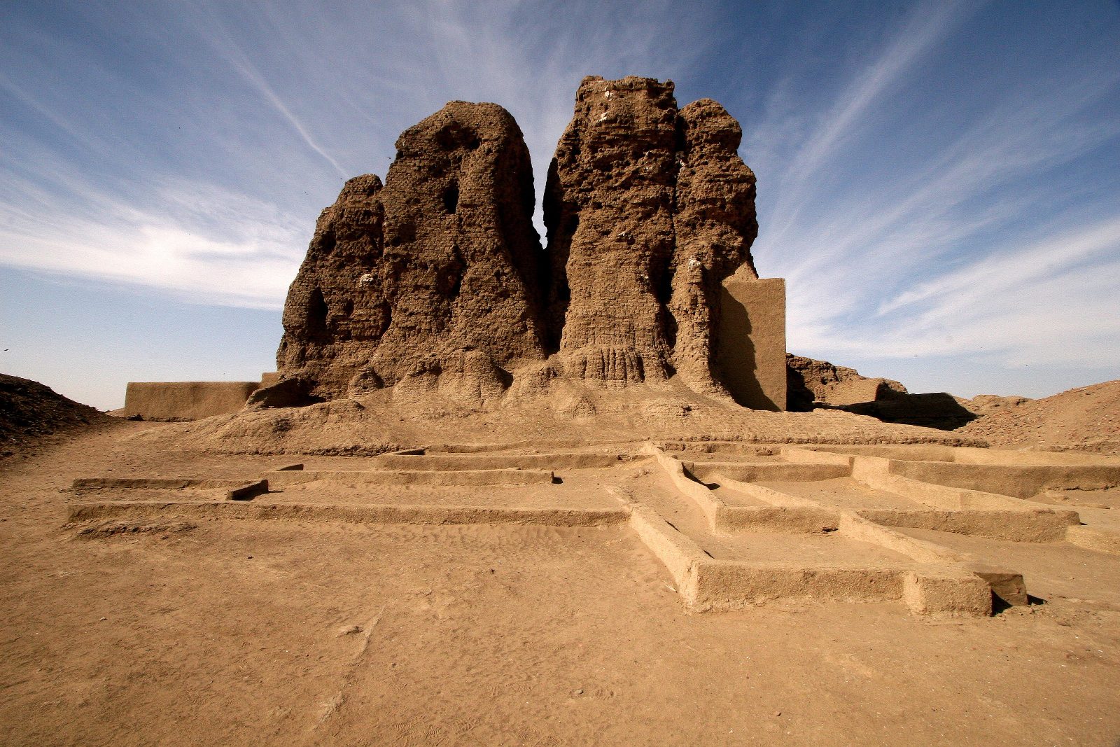
The Western Deffufa

The spiritual heart was the Western Deffufa — a colossal temple of millions of sun-baked bricks, rising over 18 metres. Its builders rejected foreign iconography, relying on an indigenous animist and cosmic theology.

A sovereign African empire that held regional dominance for over a thousand years.The royal necropolis of Kerma

The surrounding royal tumuli, ringed with black sandstone and white quartz pebbles, testify to a state that answered to no one but itself.

فوقَ سهولِ الشلّالِ الثالثِ الخصبة، بلغت كرمةُ ذروتَها المعماريّةَ والسياسيّةَ خارجَ أيِّ فلكٍ إمبراطوريٍّ أجنبيّ. صُمّمتِ العاصمةُ بأحياءٍ سكنيّةٍ متخصّصة، ومسابكِ برونز، وورشٍ للفاينسِ الأزرقِ والكوارتزِ المزجّج.

الدَّفُّوفة الغربيّة

كان القلبُ الروحيُّ هو الدَّفُّوفةَ الغربيّة — معبدٌ هائلٌ من ملايينِ الطّوبِ المجفّفِ بالشمس، يرتفعُ أكثرَ من 18 متراً. رفضَ بنّاؤوها الأيقوناتِ الأجنبيّة، معتمدينَ على عقيدةٍ محليّةٍ كونيّة.

إمبراطوريّةٌ أفريقيّةٌ ذاتُ سيادةٍ بسطت هيمنتَها أكثرَ من ألفِ عام.الجبّانةُ الملكيّةُ بكرمة

والمقابرُ الملكيّةُ المحيطةُ، المطوّقةُ بالحجرِ الرمليِّ الأسودِ وحصى الكوارتزِ الأبيض، تشهدُ على دولةٍ لم تُجِب أحداً سوى نفسِها.

II — Chapter Twoالفصل الثانيChapitre DeuxCapítulo DosKapitel Zwei

The Granite Sentinels of Barkal.حُرّاسُ البركلِ الجرانيتيّون.Les sentinelles de granite de Barkal.Los centinelas de granito de Barkal.Die Granitwächter von Barkal.

A sandstone mesa rising about 100 metres above the desert — the sacred epicentre of the Kushite Empire and dwelling-place of the god Amun.هضبةٌ رمليّةٌ تشمخُ 104 أمتارٍ فوقَ الصحراء — قلبُ مملكةِ كوشَ المقدّس، وموطنُ الإلهِ آمون.

≈100 m Holy mountain≈100 م الجبل المقدّس·Napata·Amun

The mountain where kings were made.الجبلُ الذي يُصنَعُ فيه الملوك.

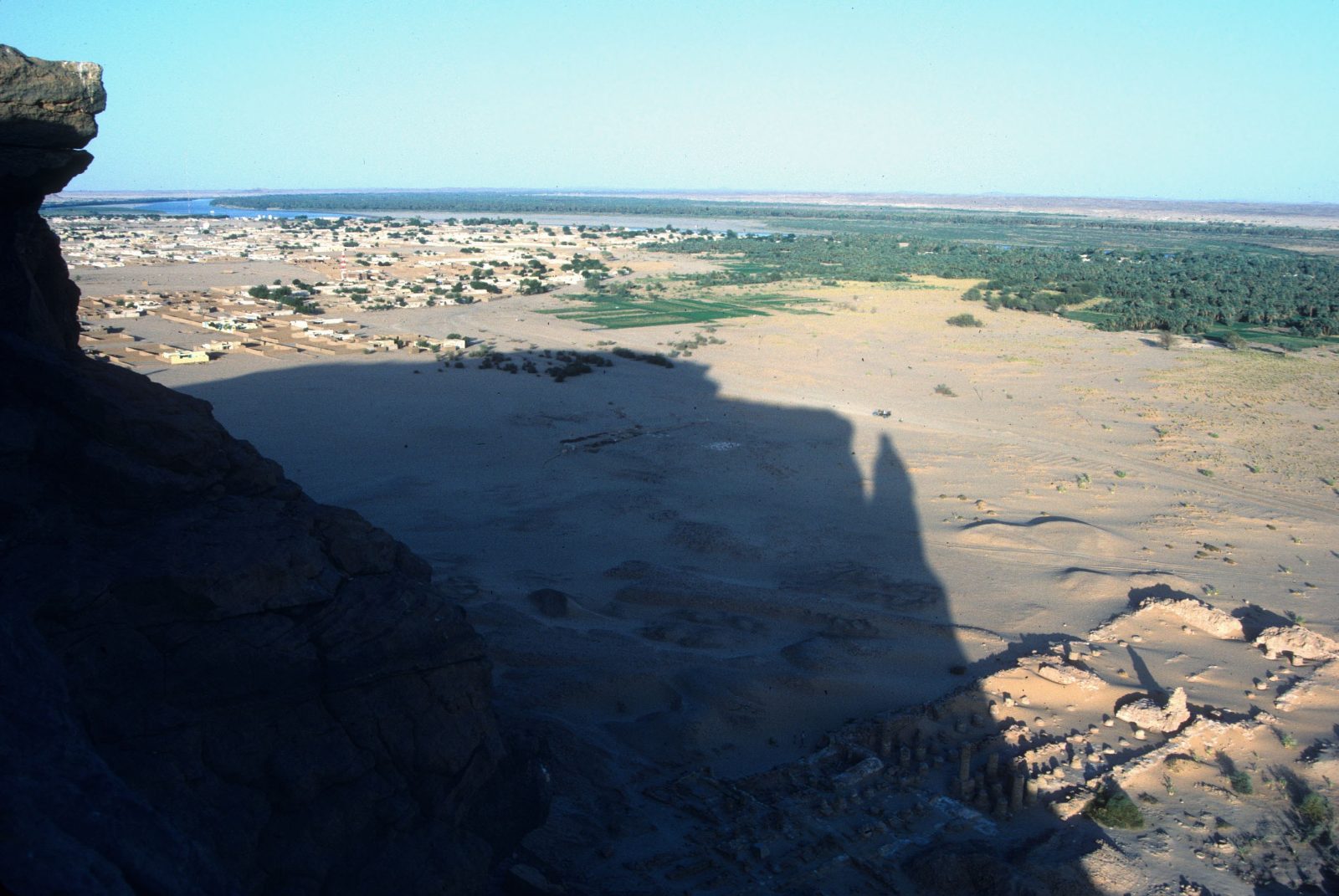
Rising abruptly from flat desert, the isolated mesa of Jebel Barkal was the ultimate sacred epicentre of the Kushite Empire. Its sheer cliffs were recognised as the earthly dwelling of the god Amun.

The sacred landscape of Napata

At its base the kings built the Great Temple of Amun and the rock-cut Temple of Mut. No king could ascend the throne without travelling here for the god's blessing.

An enduring symbol of a completely autonomous, high-culture African state.The Palace of Natakamani

In the Meroitic golden age they raised the Palace of Natakamani on a platform over 61 metres a side, adorned with glazed tiles and sandstone columns.

ناهضاً فجأةً من الصحراءِ المسطّحة، كان جبلُ البركلِ المنعزلُ القلبَ المقدّسَ لمملكةِ كوش. عُرفت جروفُه الشاهقةُ موطناً أرضيّاً للإلهِ آمون.

مجمعُ نبتةَ المقدّس

عند سفحهِ بنى الملوكُ معبدَ آمونَ الكبيرَ ومعبدَ موتَ المنحوتَ في الصخر. ما كان ملكٌ يجلسُ على العرشِ دونَ أن يأتيَ هنا لبركةِ الإله.

رمزٌ خالدٌ لدولةٍ أفريقيّةٍ ذاتِ سيادةٍ وثقافةٍ رفيعة.قصرُ نتكامني

وفي العصرِ المرويِّ الذهبيِّ رفعوا قصرَ نتكامني على منصّةٍ يزيدُ ضلعُها على 61 متراً، مزيّنةً بالقاشانيِّ وأعمدةِ الحجرِ الرمليّ.

III — Chapter Threeالفصل الثالثChapitre TroisCapítulo TresKapitel Drei

The Green Crown of the West.التاجُ الأخضرُ في الغرب.La couronne verte de l'Ouest.La corona verde del Oeste.Die grüne Krone des Westens.

In the heart of Darfur, the volcanic massif of Jebel Marra rises green and cool above the desert — Sudan's highest land, and its most fertile secret.في قلبِ دارفور، يرتفعُ جبلُ مرّةَ البركانيُّ أخضرَ بارداً فوقَ الصحراء — أعلى أراضي السودان، وأخصبُ أسرارِها.

3,042 m Summit3042 م القمّة·Deriba Crater lakes·Darfur

A volcano that the desert keeps green.بركانٌ تُبقيهِ الصحراءُ أخضر.

Jebel Marra is the great exception to the Sudanese desert. A dormant volcanic massif at the heart of Darfur, it climbs to 3,042 metres — the highest point in the country — and catches enough rain to stay green when everything around it is sand.

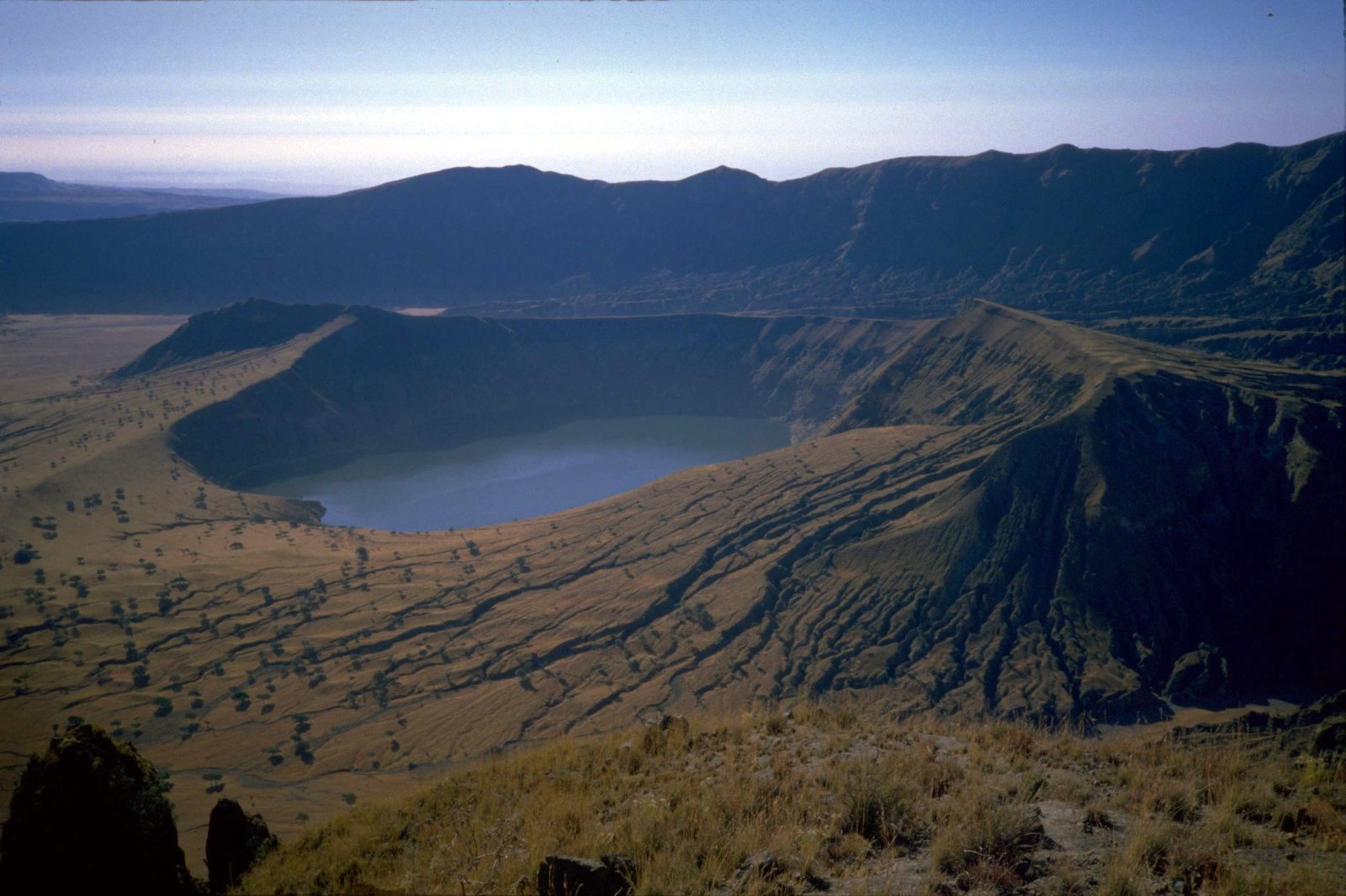
The crater lakes of Deriba

At its summit lie the Deriba lakes, twin crater pools of startling blue, formed by a vast eruption millennia ago. Hot springs, waterfalls and terraced orchards of citrus, pomegranate and grain ring the slopes below.

The west is not the edge of Sudan. It is one of its greenest hearts.The massif of Jebel Marra

For the Fur and the communities of the western highlands, Marra is homeland, larder and landmark at once — a cool, fertile world that few outside Sudan know exists.

جبلُ مرّةَ هو الاستثناءُ الكبيرُ في صحراءِ السودان. كتلةٌ بركانيّةٌ خامدةٌ في قلبِ دارفور، ترتفعُ إلى 3042 متراً — أعلى نقطةٍ في البلاد — وتلتقطُ من المطرِ ما يكفي لتبقى خضراءَ وكلُّ ما حولها رمل.

بحيرتا فوهةِ دريبة

عند قمّتِها تقعُ بحيرتا دريبة، بِركتا فوهةٍ توأمانِ بزرقةٍ مذهلة، تشكّلتا من ثورانٍ هائلٍ قبلَ آلافِ السنين. وتُطوّقُ المنحدراتِ أسفلَها ينابيعُ حارّةٌ وشلّالاتٌ وبساتينُ مدرّجةٌ من الحمضيّاتِ والرمّانِ والحبوب.

الغربُ ليس حافّةَ السودان. بل أحدُ أكثرِ قلوبِه خُضرة.كتلةُ جبلِ مرّة

وعندَ الفورِ ومجتمعاتِ المرتفعاتِ الغربيّة، مرّةُ وطنٌ ومخزنٌ ومَعلمٌ في آن — عالمٌ باردٌ خصيبٌ قلّما يعرفُ أحدٌ خارجَ السودانِ أنّه موجود.

IV — Chapter Fourالفصل الرابعChapitre QuatreCapítulo CuatroKapitel Vier

The Emerald Spires of Kassala.صروحُ كسلا الزمرّديّة.Les flèches émeraude de Kassala.Las agujas esmeralda de Kassala.Die smaragdenen Türme von Kassala.

The Taka Mountains break the eastern horizon with granite domes that rise sheer from the savannah — a crossroads of culture, water and song.جبالُ التاكا تكسرُ أفقَ الشرقِ بقبابٍ جرانيتيّةٍ تنهضُ شاهقةً من السهل — ملتقى الثقافةِ والماءِ والغناء.

Taka Granite domesالتاكا قباب جرانيت·Gash River·Totil Spring

Granite domes, an inland river, and a promise to return.قبابٌ من جرانيت، ونهرٌ داخليّ، ووعدٌ بالعودة.

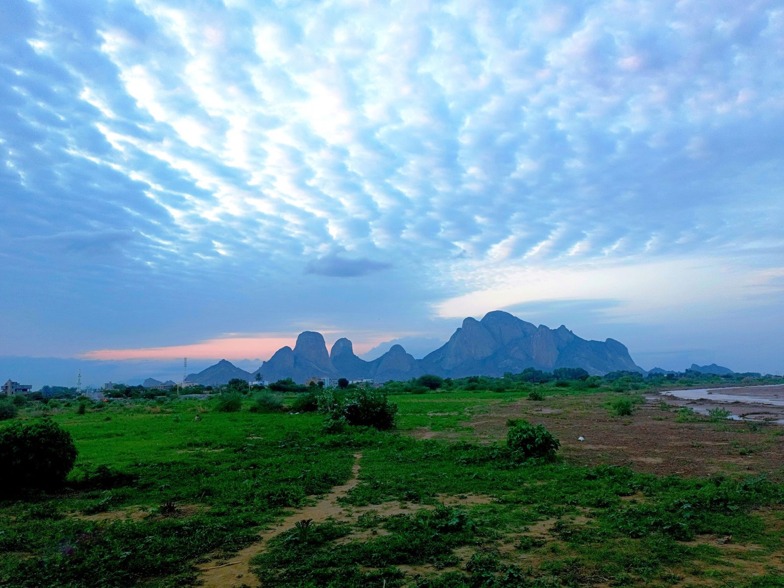
The dramatic Taka Mountains rise abruptly from the savannah as the backdrop to Kassala, a historic cultural crossroads near the eastern frontier.

The river that never reaches the sea

The seasonal Gash is an endorheic river — it never empties into any ocean, instead terminating in an inland delta, creating a fertile sanctuary of fruit orchards amid the semi-arid plains.

Whoever drinks of its pure waters is destined to return to Kassala.The legend of the Totil Spring

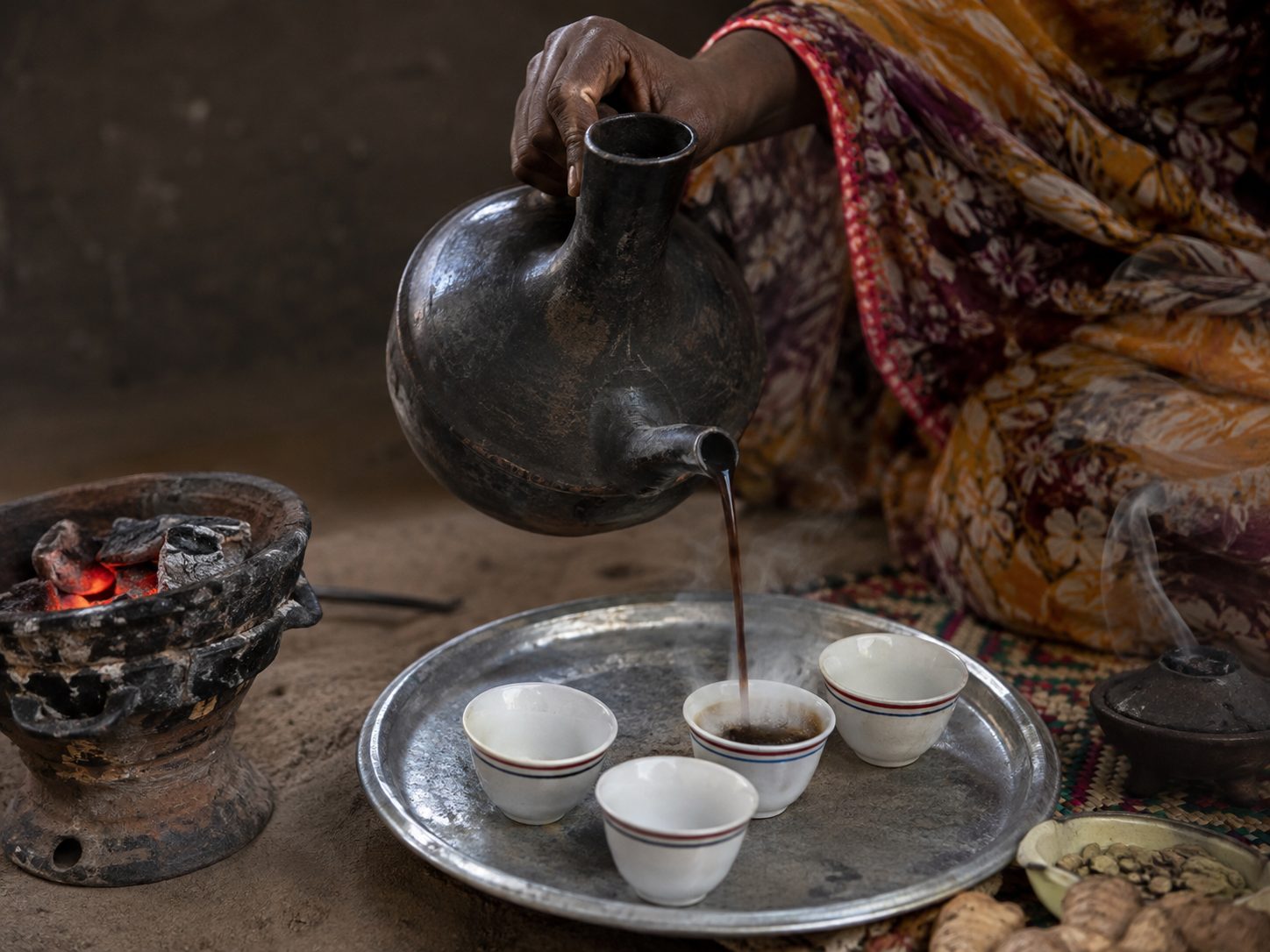
The region's heritage lives in the elaborate jebena coffee ceremony and the sword dances of the Beja, whose synchronised movements display a fierce, independent martial history.

تنهضُ جبالُ التاكا المهيبةُ فجأةً من السهلِ خلفيّةً لكسلا، ملتقى الثقافاتِ التاريخيِّ قربَ الحدودِ الشرقيّة.

النهرُ الذي لا يبلغُ البحر

القاشُ الموسميُّ نهرٌ داخليّ — لا يصبُّ في بحر، بل ينتهي في دلتا داخليّةٍ تصنعُ واحةً خصبةً من بساتينِ الفاكهةِ وسطَ السهولِ شبهِ القاحلة.

من شربَ من مائِها الصافي حُتِمَ عليهِ أن يعودَ إلى كسلا.أسطورةُ بئرِ توتيل

يعيشُ تراثُ المنطقةِ في طقسِ الجبنةِ المفصّل، وفي عرضةِ السيفِ عند البجا، حيثُ تنطقُ حركاتُهم المتناغمةُ بتاريخٍ بأسٍ واستقلال.

V — Chapter Fiveالفصل الخامسChapitre CinqCapítulo CincoKapitel Fünf

The Sunken Citadel of Suakin.قلعةُ سواكنَ الغارقة.La citadelle engloutie de Suakin.La ciudadela hundida de Suakin.Die versunkene Zitadelle von Suakin.

A perfectly circular island in a Red Sea inlet — a masterwork of coral-stone engineering, and Africa's gateway to the wider world.جزيرةٌ مدوّرةٌ تماماً في مرسًى على البحرِ الأحمر — تحفةُ هندسةٍ من حجرِ المرجان، وبوّابةُ أفريقيا إلى العالم.

Coral Islandمرجان الجزيرة·Roshan Casements·Red Sea

A city cut entirely from the living reef.مدينةٌ نُحِتت بكاملِها من الشِّعابِ الحيّة.

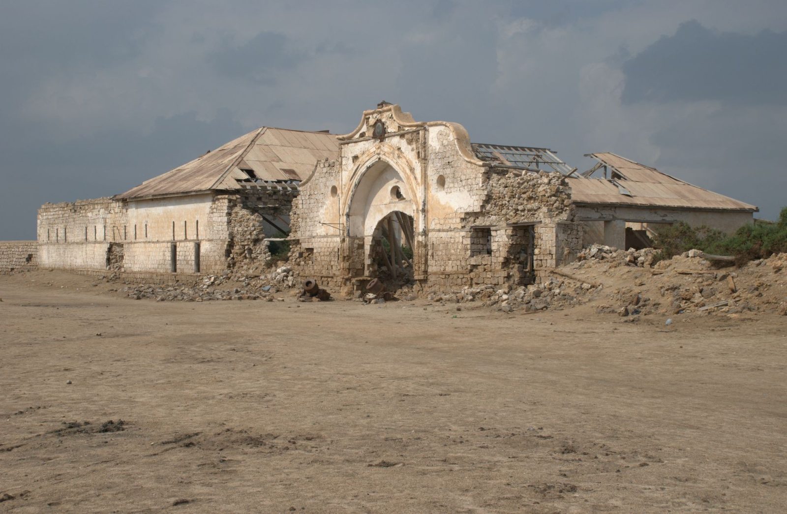
On a perfectly circular island in a protected Red Sea inlet, Suakin was for millennia the gateway connecting the African interior with the Indian Ocean, the Mediterranean, and the pilgrimage routes to Mecca.

Red Sea architecture

Every house, mosque and public building was built entirely of hand-cut madrepore coral quarried from the sea-bed, coated in sun-reflecting white lime, and fitted with carved teak casement windows called Roshan.

A sovereign coastal fortress where African, Ottoman and Indian maritime legacies merged.The sea-gates of Suakin

Though the coral structures now rest in evocative ruins, the documentation of its sea-gates and submerged wrecks reveals a dense, multi-layered history.

على جزيرةٍ مدوّرةٍ تماماً في مرسًى محميٍّ بالبحرِ الأحمر، كانت سواكنُ لآلافِ السنينَ البوّابةَ الرابطةَ بين قلبِ أفريقيا والمحيطِ الهنديِّ والبحرِ المتوسّطِ ودروبِ الحجِّ إلى مكّة.

عمارةُ البحرِ الأحمر

كلُّ بيتٍ ومسجدٍ ومبنًى عامٍّ بُنيَ بالكاملِ من حجرِ المرجانِ المقطوعِ يدويّاً من قاعِ البحر، مكسوّاً بالجيرِ الأبيضِ العاكسِ للشمس، ومزوّداً بنوافذِ الساجِ المنحوتةِ المسمّاةِ بالرواشين.

قلعةٌ ساحليّةٌ ذاتُ سيادةٍ التقت فيها موروثاتُ أفريقيا والعثمانيّينَ والهندِ البحريّة.بواباتُ سواكنَ البحريّة

ورغمَ أنَّ المبانيَ المرجانيّةَ صارت أطلالاً موحية، يكشفُ توثيقُ بواباتِها البحريّةِ وحطامِها الغارقِ عن تاريخٍ كثيفٍ متعدّدِ الطبقات.

VI — Chapter Sixالفصل السادسChapitre SixCapítulo SeisKapitel Sechs

Hands of the People.أيادي الناس.Les mains du peuple.Manos del pueblo.Hände des Volkes.

The kingdoms ended; the craft did not. The jebena pot, the woven tabag, the painted door and bridal henna carry the archive forward, hand to hand.انتهتِ الممالك؛ لكنَّ الحرفةَ لم تنتهِ. إبريقُ الجبنة، والطبقُ المنسوج، والبابُ المرسوم، وحنّاءُ العروس، تحملُ الأرشيفَ قُدُماً، يداً بيد.

The Meroitic scriptالكتابة المرويةL'écriture méroïtiqueLa escritura meroíticaDie meroitische Schrift

We can read it. We cannot understand it. نستطيع قراءتها. ولا نستطيع فهمها. Nous savons la lire. Nous ne la comprenons pas. Sabemos leerla. No sabemos entenderla. Wir können sie lesen. Verstehen können wir sie nicht.

Around the 3rd century BC the scribes of Kush stopped borrowing and invented a script of their own — 23 signs, one of the earliest writing systems in sub-Saharan Africa. It ran right to left, exactly as Arabic runs on this page. نحو القرن الثالث قبل الميلاد كفّ كتبة كوش عن الاستعارة واخترعوا كتابةً خاصةً بهم — ثلاثةٌ وعشرون علامة، من أقدم نظم الكتابة في أفريقيا جنوب الصحراء. وكانت تُكتب من اليمين إلى اليسار، تماماً كما تجري العربية في هذه الصفحة. Vers le IIIe siècle av. J.-C., les scribes de Koush inventèrent leur propre écriture — 23 signes, l'un des premiers systèmes d'écriture d'Afrique subsaharienne. Elle se lisait de droite à gauche, comme l'arabe sur cette page. Hacia el siglo III a.C. los escribas de Kush inventaron su propia escritura — 23 signos, uno de los primeros sistemas de escritura del África subsahariana. Se leía de derecha a izquierda, como el árabe en esta página. Um das 3. Jahrhundert v. Chr. erfanden die Schreiber von Kusch eine eigene Schrift — 23 Zeichen, eines der frühesten Schriftsysteme Afrikas südlich der Sahara. Sie lief von rechts nach links, genau wie das Arabische auf dieser Seite.

Kush had written in Egyptian hieroglyphs for centuries. Then, in about the 3rd century BC, its scribes built something of their own: two scripts for one language — a hieroglyphic form for monuments and temple walls, and a flowing cursive for everyday writing, on papyrus, parchment, potsherds and ostraca. The cursive did the daily work; the hieroglyphs did the ceremony.

Twenty-three signs, and one invention

Each script carries 23 signs: 15 consonants, 4 vowels — one of them only ever appearing at the start of a word — and 4 syllable signs, for ne, se, te and to. Texts ran right to left, and sometimes vertically.

And Meroitic did something almost no ancient script did: it marked where one word ended and the next began, with a separator resembling a colon. Egyptian hieroglyphs ran unbroken. Greek ran unbroken. Kush wrote with the equivalent of spaces, more than two thousand years ago.

Deciphered, and still silent

In 1909 the British archaeologist Francis Llewellyn Griffith found the key — a stand bearing the names of Meroitic rulers in both Meroitic and Egyptian hieroglyphs. From it he matched the two Meroitic scripts to each other and to sound. Every sign can now be pronounced.

What is still missing is meaning. There is no Rosetta Stone for Meroitic — no long bilingual text against a language we know. So a few thousand surviving inscriptions can be read aloud and only partly understood: royal names, gods, titles, borrowed Egyptian words. The linguist Claude Rilly has since placed Meroitic in the Northern Eastern Sudanic branch of Nilo-Saharan, alongside Nubian, Nara, Tama and Nyimang — which is slowly opening the vocabulary from the side.

It is, in the most literal sense, a living archive still waiting to be read.

كتبت كوشُ بالهيروغليفية المصرية قروناً. ثم، نحو القرن الثالث قبل الميلاد، بنى كتبتها شيئاً خاصاً بهم: كتابتين للغةٍ واحدة — صورةٌ هيروغليفية للنُّصُب وجدران المعابد، وخطٌّ متصلٌ سيّالٌ للكتابة اليومية على البردي والرقّ والشقافات. الخطُّ المتصل كان يؤدي العمل اليومي، والهيروغليفية تؤدي الاحتفال.

ثلاثةٌ وعشرون علامة، وابتكارٌ واحد

تحمل كلُّ كتابةٍ 23 علامة: خمس عشرة صامتة، وأربع صائتة — إحداها لا ترد إلا في أول الكلمة — وأربع علاماتٍ مقطعية لـني وسي وتي وتو. وكانت النصوص تجري من اليمين إلى اليسار، وأحياناً رأسياً.

وفعلت المروية ما لم تكد تفعله كتابةٌ قديمة: أشارت إلى حيث تنتهي كلمةٌ وتبدأ أخرى، بفاصلٍ يشبه النقطتين. الهيروغليفية المصرية كانت تجري متصلة، واليونانية كذلك. أما كوش فكتبت بما يعادل المسافات، قبل أكثر من ألفي عام.

فُكَّت رموزها، وما زالت صامتة

في عام 1909 وجد الأثريّ البريطاني فرانسيس لويلين غريفيث المفتاح — قاعدةٌ تحمل أسماء ملوكٍ مرويين بالمروية والهيروغليفية المصرية معاً. ومنها طابق بين الكتابتين المرويتين وبين الأصوات. فصار كلُّ علامةٍ اليوم يُنطق.

والناقص هو المعنى. فلا حجر رشيد للمروية — لا نصَّ ثنائيَّ اللغة طويلاً بإزاء لغةٍ نعرفها. ولذلك تُقرأ آلافُ النقوش الباقية بصوتٍ عالٍ ولا تُفهم إلا جزئياً: أسماءُ ملوكٍ وآلهةٍ وألقابٌ وكلماتٌ مستعارة. وقد وضع اللغويّ كلود ريلي المرويةَ في فرع السودانية الشرقية الشمالية من الأسرة النيلية الصحراوية، إلى جانب النوبية والنارا والتاما والنيمانج — وهو ما يفتح المعجم رويداً من جانبه.

إنها، بالمعنى الحرفيّ تماماً، أرشيفٌ حيٌّ ما زال ينتظر من يقرأه.
Sources: Britannica, Meroitic language — the 23 signs, Griffith's decipherment from the funerary texts, and the right-to-left direction · Claude Rilly, The Meroitic Language and Writing System (Cambridge) — the Northern Eastern Sudanic classification · R. Smith, "Constructing word similarities in Meroitic as an aid to decipherment," British Museum Studies in Ancient Egypt and Sudan — the word separator and the absence of a bilingual key · Unicode Consortium, Meroitic Hieroglyphs chart.
المصادر: بريتانيكا، اللغة المروية — العلامات الـ23 وفكُّ غريفيث للرموز واتجاه الكتابة · كلود ريلي، اللغة والكتابة المروية (كامبريدج) — التصنيف السوداني الشرقي الشمالي · ر. سميث، «بناء تشابهات الكلمات في المروية»، دراسات المتحف البريطاني — الفاصل بين الكلمات وغياب المفتاح الثنائي · اتحاد يونيكود، جدول الهيروغليفية المروية.

The RecordالسجلLe RegistreEl RegistroDas Register

Six things Sudan did first. ستّةُ أمورٍ سبق السودانُ إليها. Six choses que le Soudan a faites en premier. Seis cosas que Sudán hizo primero. Sechs Dinge, die Sudan zuerst tat.

Every claim on this page is sourced. Where scholarship disagrees, we say so and give the range. Follow any citation to the primary record. كلُّ ما في هذه الصفحة موثَّق بمصدره. وحيث تختلف المصادر نقول ذلك ونذكر المدى. اتبع أيَّ مرجعٍ إلى أصله. Chaque affirmation de cette page est sourcée. Là où les études divergent, nous le disons et donnons la fourchette. Cada afirmación de esta página está documentada. Donde los estudios discrepan, lo decimos y damos el rango. Jede Aussage auf dieser Seite ist belegt. Wo die Forschung abweicht, sagen wir es und nennen die Spanne.

c. 2500 BC · Kerma

A city on the Nile, standing on its own

UNESCO records Kerma as the capital of the first Kingdom of Kush and the site of one of the earliest urban centres in sub-Saharan Africa, flourishing between 2500 and 1500 BC and reaching from the 1st to the 5th cataract. By 1700 BC the city held a population of at least 10,000, with roads, a palace, an audience hall and workshops.

UNESCO World Heritage Tentative List, Monuments of the Kingdom of Kermawhc.unesco.org/en/tentativelists/6594 · Swiss-Franco-Sudanese Archaeological Mission, Kerma–Dukki Gel

نحو 2500 ق.م · كرمة

مدينةٌ على النيل، قائمةٌ بذاتها

تسجّل يونسكو كرمة عاصمةً لأول مملكة كوش وموقعاً لـواحدٍ من أقدم المراكز الحضرية في أفريقيا جنوب الصحراء، ازدهر بين 2500 و1500 ق.م وامتدّ من الشلال الأول إلى الخامس. وبحلول 1700 ق.م بلغ سكانها عشرة آلاف على الأقل، بطرقٍ وقصرٍ وقاعة استقبالٍ وورش.

القائمة التمهيدية لليونسكو، آثار مملكة كرمةwhc.unesco.org · البعثة السويسرية-الفرنسية-السودانية، كرمة ودكي قيل

c. 1750 BC · The Western Deffufa

Monumental architecture in mud brick

The Western Deffufa is described as one of the oldest known monumental structures in the Nile Valley — built entirely of sun-dried mudbrick, rising roughly 18 to 20 metres, with interior chambers and courtyards for ritual. Kerma's craftsmen developed their own techniques for blue faience and glazed quartzite.

Wikipedia, Western Deffufa (c. 2500 BC, ~20 m) — en.wikipedia.org/wiki/Western_Deffufa · Archaeology Magazine, "A Nubian Kingdom Rises," Sept/Oct 2020 (65 ft)

نحو 1750 ق.م · الدَّفُّوفة الغربية

عمارةٌ ضخمة من الطوب اللبن

تُوصَف الدفوفة الغربية بأنها من أقدم الصروح المعروفة في وادي النيل — بُنيت كلُّها من طوبٍ مجفّفٍ بالشمس، وترتفع نحو 18 إلى 20 متراً، وفي داخلها حُجراتٌ وأفنيةٌ للطقوس. وقد طوّر صُنّاع كرمة تقنياتهم الخاصة في الفخار الأزرق والكوارتز المزجّج.

ويكيبيديا، الدفوفة الغربيةen.wikipedia.org · مجلة Archaeology، «مملكة نوبية تنهض»، 2020

21 BC · Treaty of Samos

Amanirenas and Rome: a war that ended in a favourable settlement

Between 25 and 22 BC Kush fought Rome along the southern frontier of Roman Egypt. Strabo, writing in his Geography, records that the envoys of the Kandake "obtained everything they pled for," and that Augustus remitted the tribute he had imposed — terms settled at Samos that held for some three centuries. Strabo names the ruler only by the title Candace; modern scholarship commonly identifies her as Amanirenas, an interpretation rather than a fact of the text.

Strabo, Geography Book XVII · Wikipedia, Amanirenasen.wikipedia.org/wiki/Amanirenas · HISTORY, "The Nubian Queen Who Fought Back Caesar's Army"

21 ق.م · صلح ساموس

أماني ريناس وروما: حربٌ انتهت بتسويةٍ لصالح كوش

بين 25 و22 ق.م حاربت كوشُ رومَ على الحدّ الجنوبي لمصر الرومانية. ويسجّل سترابو في جغرافيته أن سفراء الكنداكة «نالوا كلَّ ما طلبوه»، وأن أوغسطس أعفاهم من الجزية التي فرضها — شروطٌ استُقرّت في ساموس وصمدت نحو ثلاثة قرون. ولا يذكر سترابو للملكة إلا لقب «كنداكة»؛ وتُرجّح الدراسات الحديثة أنها أماني ريناس، وهو ترجيحٌ لا نصّ.

سترابو، الجغرافيا الكتاب السابع عشر · ويكيبيديا، أماني ريناسen.wikipedia.org · HISTORY

652 AD · Old Dongola

The Baqt: centuries of negotiated coexistence

The Nubian kingdom of Makuria turned back an Arab army at Dongola in 642 and again in 652 — Muslim chroniclers singled out the skill of the Nubian archers. Rather than conquest, the two powers entered the Baqt: an exchange of goods and mutual non-aggression, conventionally dated to 652, which evolved over roughly six to seven centuries. No original text of the agreement survives and later accounts differ on its terms.

Ibn Abd al-Hakam, Futuh Misr · Wikipedia, Baqten.wikipedia.org/wiki/Baqt · Wikipedia, Kingdom of Makuria

652 م · دنقلا العجوز

البقط: قرونٌ من تعايشٍ متفاوَض عليه

ردّت مملكة المقرّة النوبية جيشاً عربياً عند دنقلا عام 642 ثم مرةً أخرى عام 652 — وقد خصّ المؤرخون المسلمون مهارة النبّالة النوبيين بالذكر. وبدلاً من الفتح دخلت القوتان في البقط: تبادلٌ للسلع وعدمُ اعتداءٍ متبادل، يُؤرَّخ عادةً بعام 652، وتطوّر عبر نحو ستة إلى سبعة قرون. ولم يصلنا نصٌّ أصليٌّ للاتفاق، وتختلف الروايات المتأخرة في شروطه.

ابن عبد الحكم، فتوح مصر · ويكيبيديا، البقطen.wikipedia.org · ويكيبيديا، مملكة المقرّة

Inscribed 2011 · Island of Meroë

The royal necropolises of Meroë

Meroë's royal necropolises contain more than 200 graves, many of them marked by the steep-sided pyramids that became an emblem of Kush. UNESCO inscribed the Island of Meroë in 2011 as the heartland of Kush, a major power from the 8th century BC to the 4th century AD. The pyramids are markedly steeper and narrower than most, the tallest about 30 m. Note that graves and standing pyramids are not interchangeable counts.

UNESCO ref 1336 and ICOMOS evaluation — whc.unesco.org/document/152412 · UNESCO ref 1336 — whc.unesco.org/en/list/1336

مُدرج 2011 · جزيرة مروي

جبانات مروي الملكية

تضمّ جبانات مروي الملكية أكثر من مئتي مدفن، ويعلو كثيراً منها الهرم شديد الانحدار الذي صار رمزاً لكوش. وقد أدرجت يونسكو جزيرة مروي عام 2011 قلباً لمملكة كوش، القوة الكبرى من القرن الثامن ق.م إلى الرابع الميلادي. وأهرامها أحدُّ ميلاً وأضيقُ قاعدة، أطولها نحو 30 متراً. ويُنبَّه إلى أن عدد المدافن ليس هو عدد الأهرام القائمة.

كتاب حقائق العالم، السودان — cia.gov · يونسكو رقم 1336 — whc.unesco.org

1504 – 1821 · Sennar

The Funj Sultanate, a state in its own right

For three centuries the Funj Sultanate, centred on Sennar on the Blue Nile, held together a state that linked the Red Sea trade routes, the Ethiopian highlands and the wider Sahel. Its court, its scholars and its long accommodation with the Abdallab of the north make it a major chapter of Sudanese history — not an interval between ancient Kush and modern rule.

UNESCO, General History of Africa III — unesdoc.unesco.org · Cambridge World History, Africa: States, Empires, and Connections

1504 – 1821 · سنار

سلطنة الفونج، دولةٌ قائمة بذاتها

ثلاثة قرونٍ حكمت سلطنة الفونج من سنار على النيل الأزرق دولةً وصلت طرق تجارة البحر الأحمر بالهضبة الحبشية والساحل الأفريقي الأوسع. وبلاطها وعلماؤها ووفاقها الطويل مع العبدلاب في الشمال تجعل منها فصلاً كبيراً في تاريخ السودان — لا فاصلاً بين كوش القديمة والحكم الحديث.

يونسكو، تاريخ أفريقيا العام ج3 — unesdoc.unesco.org · Cambridge World History

Inscribed 2016 · Sanganeb & Dungonab

The Red Sea’s only atoll-like feature

UNESCO describes Sanganeb as the only atoll-like feature in the Red Sea — not an atoll in the strict sense — lying 25 km offshore, ringed by water 800 m deep, with 13 bio-physiographic reef zones and over 300 fish species. Dungonab Bay, 125 km north of Port Sudan, holds a globally significant population of dugongs. It remains the first and only World Heritage site in the Red Sea.

UNESCO ref 262 — whc.unesco.org/en/list/262 · IUCN World Heritage Outlook · UNEP-WCMC World Heritage Datasheet

مُدرج 2016 · سنقنيب ودنقناب

البنية الحلقية المرجانية الوحيدة في البحر الأحمر

تصف يونسكو سنقنيب بأنها البنية الشبيهة بالجزيرة المرجانية الحلقية الوحيدة في البحر الأحمر — لا جزيرةً حلقيةً بالمعنى الدقيق — على 25 كم من الساحل، يحيط بها ماءٌ عمقه 800 متر، وفيها 13 نطاقاً مرجانياً حيويّاً متمايزاً وأكثر من 300 نوعٍ من الأسماك. ويضمّ خليج دنقناب، على 125 كم شمال بورتسودان، تجمّعاً عالميَّ الأهمية من أبقار البحر. وهو أول وآخر موقع تراثٍ عالميّ في البحر الأحمر حتى اليوم.

يونسكو رقم 262 — whc.unesco.org · مرصد التراث العالمي IUCN · UNEP-WCMC

Sources consultedالمصادر المُراجَعةSources consultéesFuentes consultadasVerwendete Quellen